
IMAGES TAKEN NEAR TO
Kingsfield Steadings, LINLITHGOW, EH49 7NY
Introduction
This page details the photographs taken nearby to Kingsfield Steadings, EH49 7NY by members of the Geograph project.
The Geograph project started in 2005 with the aim of publishing, organising and preserving representative images for every square kilometre of Great Britain, Ireland and the Isle of Man.

There are currently over 7.5m images from over14,400 individuals and you can help contribute to the project by visiting https://www.geograph.org.uk
Image Map
Images are licensed for reuse under creativecommons.org/licenses/by-sa/2.0
Notes
- Clicking on the map will re-center to the selected point.
- The higher the marker number, the further away the image location is from the centre of the postcode.
Image Listing (6 Images Found)
Images are licensed for reuse under creativecommons.org/licenses/by-sa/2.0
Image
Details
Distance
1

Farmland, Kingsfield
Just outside Linlithgow, for now.
Image: © Richard Webb
Taken: 10 Jun 2013
0.14 miles
2
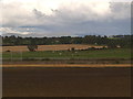
Farmland across railway
Arable fields seen from the towpath of the Union Canal east of Linlithgow.
Image: © James Allan
Taken: 9 Sep 2017
0.16 miles
3

Stubble by Kingsfield
Arable land just outside Linlithgow.
Image: © Richard Webb
Taken: 30 Aug 2011
0.16 miles
4

Farmland near Linlithgow
Kingsfield Golf Centre http://www.kingsfieldgolf.com/ can be seen on the hill. Viewed from a Glasgow bound train.
Image: © Thomas Nugent
Taken: 29 Aug 2016
0.19 miles
5

New Bistro beside Union Canal
Example of Farm diversification a new Bistro ready to open to serve increased tourist traffic on Union Canal outside Linlithgow. Barge visible on the canal
Image: © paul birrell
Taken: 4 Jun 2005
0.20 miles
