
IMAGES TAKEN NEAR TO
Jocks Hill Crescent, LINLITHGOW, EH49 7BJ
Introduction
This page details the photographs taken nearby to Jocks Hill Crescent, EH49 7BJ by members of the Geograph project.
The Geograph project started in 2005 with the aim of publishing, organising and preserving representative images for every square kilometre of Great Britain, Ireland and the Isle of Man.

There are currently over 7.5m images from over14,400 individuals and you can help contribute to the project by visiting https://www.geograph.org.uk
Image Map
Images are licensed for reuse under creativecommons.org/licenses/by-sa/2.0
Notes
- Clicking on the map will re-center to the selected point.
- The higher the marker number, the further away the image location is from the centre of the postcode.
Image Listing (50 Images Found)
Images are licensed for reuse under creativecommons.org/licenses/by-sa/2.0
Image
Details
Distance
1
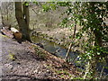
Mill lade
Near Jock's Hill, Linlithgow.
Image: © James Allan
Taken: 29 Apr 2013
0.07 miles
2

Church of St Ninian's Craigmailen, Falkirk Road, Linlithgow
Late 19th century. Church of Scotland united with the Craigmailen United Presbyterian congregation
Image: © Tim Heaton
Taken: 4 Jul 2018
0.12 miles
3

The Church of St Ninian's Craigmailen, Linlithgow
Church of Scotland.
Image: © Bill Henderson
Taken: 28 Jul 2016
0.12 miles
4
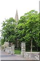
St Ninians, Craigmailen
Church at the western end of Linlithgow.
Image: © Richard Webb
Taken: 6 Jun 2013
0.12 miles
5

St Ninians, Craigmailen
Outside the church
Image: © Richard Webb
Taken: 6 Jun 2013
0.12 miles
6

Old Boundary Marker on Falkirk Road, Linlithgow
Municipal Boundary Marker on the north side of the A803 Falkirk Road in Linlithgow. Inscribed L / P B for Linlithgow Parliamentary Burgh. A modern replica. An adjacent information panel says this marks the boundary of the Burgh of Linlithgow. Information https://linlithgow.sharepoint.com/:b:/g/EcMc5qBgHJtMlRFu_7uWrnABNwnpnKoigfGz60TgXqg68Q?e=gOzd8r. See also https://www.geograph.org.uk/photo/7639804.
Milestone Society National ID: WL_LINLIT01pb
Image: © D Elis-Williams
Taken: 12 Jun 2024
0.12 miles
7

St Ninians Craigmailen Parish Church
This building dates from the 1870's with later additions
Image: © Jim Smillie
Taken: 8 Mar 2022
0.12 miles
8

Longcroft Hall, Linlithgow
The hall is situated about a hundred yards to the east of the church of St Ninian's Craigmailen. The inscription on the wall reads, "Infant School 1869" making it five years older than the adjacent church. The Longcroft Hall is now used for community events, concerts, youth groups and as a polling place. The wrought iron work on the gate has LMH, suggesting that it was perhaps built as a memorial hall.
Image: © AlastairG
Taken: 27 May 2014
0.13 miles
9

Linlithgow Fire Station
Between the fire station and house is entrance to Linlithgow Bowling Club
Image: © Jim Smillie
Taken: 8 Mar 2022
0.13 miles
10

Sheep grazing by the side of Linlithgow Loch
Across the Loch lies Linlithgow Palace, birthplace of Mary Queen of Scots, and the Royal Park.
Image: © David Francis
Taken: 13 May 2009
0.13 miles