
IMAGES TAKEN NEAR TO
Auldhill Drive, LINLITHGOW, EH49 6NL
Introduction
This page details the photographs taken nearby to Auldhill Drive, EH49 6NL by members of the Geograph project.
The Geograph project started in 2005 with the aim of publishing, organising and preserving representative images for every square kilometre of Great Britain, Ireland and the Isle of Man.

There are currently over 7.5m images from over14,400 individuals and you can help contribute to the project by visiting https://www.geograph.org.uk
Image Map
Images are licensed for reuse under creativecommons.org/licenses/by-sa/2.0
Notes
- Clicking on the map will re-center to the selected point.
- The higher the marker number, the further away the image location is from the centre of the postcode.
Image Listing (10 Images Found)
Images are licensed for reuse under creativecommons.org/licenses/by-sa/2.0
Image
Details
Distance
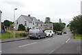
2
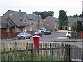
Bridgend.
Not the famed one that was home to JPR Williams, but an old oil village in the midst of West Lothian farmland. Since the oil mines closed, a lot of municipal housing has been built here, the population is now about 800.
Image: © Richard Webb
Taken: 4 Oct 2005
0.07 miles
3
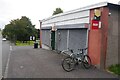
Shop and post office, Bridgend
It was open.
Image: © Richard Webb
Taken: 10 Aug 2020
0.08 miles
4

Looking across the field to Bridgend
From the main road [B9080] near Gateside.
Image: © M J Richardson
Taken: 15 Apr 2010
0.14 miles
5

Field at Bridgend
Harvested and awaiting ploughing soon or in the spring. The burn is the Haugh Burn, on its way to Philpstoun and the Pardovan Burn.
Image: © Anne Burgess
Taken: 2 Dec 2012
0.19 miles
6
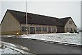
Club House for Bridgend District Golf Club
Situated on the west side of the village of Bridgend near Linlithgow.
Image: © Morley Sewell
Taken: 12 Feb 2009
0.20 miles
7

Bridgend Farm
This rather fine steading at Bridgend Farm has been converted to housing. It is a Category B Listed building.
Image: © Anne Burgess
Taken: 2 Dec 2012
0.23 miles
8

Doocot at Bridgend Farm
This is a fine example of a doocot incorporated into the arched entrance to a steading.
Image: © Anne Burgess
Taken: 2 Dec 2012
0.23 miles
9

9th Hole: Bridgend Golf Course
Note the all weather greens.
Image: © Jim Smillie
Taken: 13 Aug 2025
0.23 miles
10
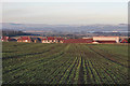
Bridgend from Uphill
Bridgend apparently dates from the 1930s, when most of the inhabitants of Kingscavil, which at one time numbered several hundred souls, were relocated here because of problems providing adequate sewage facilities at Kingscavil; or so I gather. The large building on the right is the school.
Image: © Anne Burgess
Taken: 2 Dec 2012
0.25 miles