
IMAGES TAKEN NEAR TO
Deanburn Road, LINLITHGOW, EH49 6EY
Introduction
This page details the photographs taken nearby to Deanburn Road, EH49 6EY by members of the Geograph project.
The Geograph project started in 2005 with the aim of publishing, organising and preserving representative images for every square kilometre of Great Britain, Ireland and the Isle of Man.

There are currently over 7.5m images from over14,400 individuals and you can help contribute to the project by visiting https://www.geograph.org.uk
Image Map
Images are licensed for reuse under creativecommons.org/licenses/by-sa/2.0
Notes
- Clicking on the map will re-center to the selected point.
- The higher the marker number, the further away the image location is from the centre of the postcode.
Image Listing (43 Images Found)
Images are licensed for reuse under creativecommons.org/licenses/by-sa/2.0
Image
Details
Distance
1

Flooded culvert
This culvert, which allows excess water to escape from the Union Canal, is covered with a concrete slab which facilitates access from Deanburn Road to Katie Shaw's Brig. It is normally dry but, as here, can flood after a prolonged rainy spell.
Image: © Morley Sewell
Taken: 3 Dec 2009
0.08 miles


4

Canoeist and coach, Union Canal
The canal provides ample opportunities for leisure activities, with canoeists active around Linlithgow and the towpath used by walkers and cyclists alike.
Image: © Lis Burke
Taken: 4 Apr 2009
0.08 miles
5

Barge on Union Canal
Moored west of Preston Road bridge
Image: © Jim Smillie
Taken: 9 Nov 2021
0.08 miles
6

Union Canal, Linlithgow
The canal passes high above Linlithgow Academy.
Image: © Richard Webb
Taken: 30 May 2014
0.08 miles
7

Old milemarker by the Union Canal, Linlithgow
Milemarker by the Union Canal, in parish of Linlithgow (District), West of Preston Road Winding Basin; 270 yds East of Bridge 46, on towpath.
Inscription reads:-
9
The entire canal is a Scheduled Monument.
Reference: SM8954 http://portal.historicenvironment.scot/designation/SM8954
Surveyed
Milestone Society National ID: EUC-22
Image: © Milestone Society
Taken: Unknown
0.08 miles
8
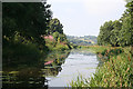
Union Canal
You would never know from this view that the canal is still in the burgh of Linlithgow. However from this point you can see how the canal follows the contours, passing above the level of the ground to the north.
Image: © Anne Burgess
Taken: 26 Aug 2013
0.09 miles
9

Union Canal at Linlithgow
From the slightly elevated vantage point of a pedestrian bridge that gives access to paths on both sides of the canal, it is apparent that the canal is passing through the suburbs, with modern housing developments to both north and south.
Image: © Anne Burgess
Taken: 26 Aug 2013
0.09 miles
10

Curvaceous canal
The Union Canal just west of Preston Road Bridge, Linlithgow.
Image: © James Allan
Taken: 27 Jan 2010
0.10 miles