
IMAGES TAKEN NEAR TO
Station Road, LINLITHGOW, EH49 6BW
Introduction
This page details the photographs taken nearby to Station Road, EH49 6BW by members of the Geograph project.
The Geograph project started in 2005 with the aim of publishing, organising and preserving representative images for every square kilometre of Great Britain, Ireland and the Isle of Man.

There are currently over 7.5m images from over14,400 individuals and you can help contribute to the project by visiting https://www.geograph.org.uk
Image Map
Images are licensed for reuse under creativecommons.org/licenses/by-sa/2.0
Notes
- Clicking on the map will re-center to the selected point.
- The higher the marker number, the further away the image location is from the centre of the postcode.
Image Listing (590 Images Found)
Images are licensed for reuse under creativecommons.org/licenses/by-sa/2.0
Image
Details
Distance
1

Linlithgow rooftops
Overlooking the railway towards the Palace.
Image: © Richard Webb
Taken: 25 Jun 2013
0.02 miles
2

No access to motor vehicles
Bollards across the top of Station Road prevent any motor vehicles from going any further. The road leads down to the station, but a sharp and narrow turning at the station itself means the road is not really suitable for most vehicles.
Image: © Richard Sutcliffe
Taken: 10 Mar 2023
0.02 miles
3

Station Road, Linlithgow
Short cut to railway station for cyclists and pedestrians.
Image: © JThomas
Taken: 29 Jun 2017
0.02 miles

5
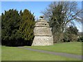
Doocot at Linlithgow
Just across the road from the canal basin.
Image: © M J Richardson
Taken: 1 Apr 2010
0.03 miles

7

Learmonth Gardens
Burgh Beautiful Linlithgow now maintain these gardens.
The doocot is in the neighbouring square.
Image: © Jim Smillie
Taken: 8 Mar 2022
0.03 miles
8

Roads and canal
Strawberry Bank on the left, becoming Back Station Road where it disappears. In the centre is Manse Road, which crosses the Category B listed bridge http://portal.historicenvironment.scot/designation/LB37482 over the Union Canal.
Image: © Richard Sutcliffe
Taken: 10 Mar 2023
0.03 miles
9

Union Canal, Linlithgow
The bridge is on Manse Road.
Image: © Richard Webb
Taken: 27 Mar 2015
0.03 miles
10

Manse Road Bridge
A dog walker about to go under Manse Road Bridge, which is Category B listed http://portal.historicenvironment.scot/designation/LB37482, dating from about 1820.
Image: © Richard Sutcliffe
Taken: 18 May 2021
0.03 miles