
IMAGES TAKEN NEAR TO
Friarsbrae, LINLITHGOW, EH49 6AZ
Introduction
This page details the photographs taken nearby to Friarsbrae, EH49 6AZ by members of the Geograph project.
The Geograph project started in 2005 with the aim of publishing, organising and preserving representative images for every square kilometre of Great Britain, Ireland and the Isle of Man.

There are currently over 7.5m images from over14,400 individuals and you can help contribute to the project by visiting https://www.geograph.org.uk
Image Map
Images are licensed for reuse under creativecommons.org/licenses/by-sa/2.0
Notes
- Clicking on the map will re-center to the selected point.
- The higher the marker number, the further away the image location is from the centre of the postcode.
Image Listing (21 Images Found)
Images are licensed for reuse under creativecommons.org/licenses/by-sa/2.0
Image
Details
Distance
1

A very snowy Rivaldsgreen Crescent, Linlithgow
About the most snow I can rememember ever falling in Linlithgow..!
Image: © C L T Smith
Taken: 23 Dec 2009
0.05 miles
2

Rosemount Park, Linlithgow
One of the town's forgotten gems
Image: © C L T Smith
Taken: 11 May 2009
0.15 miles
3

Leafy suburbs.
Manse Road, Linlithgow. Looking north towards the town centre.
Image: © Richard Webb
Taken: 14 Oct 2005
0.17 miles
4

Why change a perfectly good name?
Prior to being given, "Shoemakers' Way", the totally meaningless "Lovers' Lane" was in use until pressure called for it to be changed to the name by which it had been known for at least 100 years. The people who deal with such things went part way. The original name by which it was known by the natives of the town was, "Cobblers' Lane". Linlithgow was the centre of a thriving leather industry with one local company, Wm Morrison, producing nothing but boots for several years - the boots went to the WW1 trenches, so cobblers would have been a familiar sight in the area.
Image: © AlastairG
Taken: 6 Mar 2026
0.19 miles
5

Under Repair
This is the rear of a terrace of council housing just off Preston Crescent. The state of the garden suggests that this house is likely to be in need of some attention.
Image: © Anne Burgess
Taken: 26 Aug 2013
0.21 miles
6
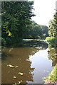
Union Canal
The canal widens just west of the bridge that leads to Friar's Brae, presumably to allow boats to wait for traffic coming the other way through the bridge.
Image: © Anne Burgess
Taken: 26 Aug 2013
0.22 miles
7

Union Canal - Preston Road Brig
Originally the bridge was of the same style as most of the others. When the canal was closed to traffic, the bridge was demolished and the canal put in a pipe. With renewed interest in the canal, the bridge was rebuilt so that boats could once again use the waterway.
Image: © AlastairG
Taken: 28 Oct 2008
0.22 miles
8

Union Canal, Linlithgow
Passing Linlithgow, the canal hugs the side of a steep hill and gives good views northwards. The Union Canal is a contour canal, there are no locks between the top of the Falkirk Wheel and Fountainbridge Basin in Edinburgh.
Image: © Richard Webb
Taken: 21 May 2014
0.22 miles
9

Play park
Children's play park near Preston Road, Linlithgow.
Image: © James Allan
Taken: 27 Jan 2010
0.23 miles
10

Canal Basin Linlithgow
Busy canal basin on Union Canal Linlithgow
Image: © paul birrell
Taken: 25 Jun 2005
0.23 miles