
IMAGES TAKEN NEAR TO
Jarvey Street, BATHGATE, EH48 4EZ
Introduction
This page details the photographs taken nearby to Jarvey Street, EH48 4EZ by members of the Geograph project.
The Geograph project started in 2005 with the aim of publishing, organising and preserving representative images for every square kilometre of Great Britain, Ireland and the Isle of Man.

There are currently over 7.5m images from over14,400 individuals and you can help contribute to the project by visiting https://www.geograph.org.uk
Image Map
Images are licensed for reuse under creativecommons.org/licenses/by-sa/2.0
Notes
- Clicking on the map will re-center to the selected point.
- The higher the marker number, the further away the image location is from the centre of the postcode.
Image Listing (29 Images Found)
Images are licensed for reuse under creativecommons.org/licenses/by-sa/2.0
Image
Details
Distance
1

Bathgate High Church
Viewed across Gideon Street car park.
Image: © Jim Smillie
Taken: 29 Jul 2010
0.04 miles
2

Bathgate
View down Drum Road towards the town centre. Another front is approaching from the west. Soon it would be raining heavily.
Image: © Richard Webb
Taken: 16 Jan 2006
0.05 miles
3
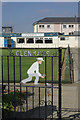
Glenmavis Bowling Club
An attractive gate design marks the entrance to this sports facility.
Image: © Stephen McKay
Taken: 7 Jun 2013
0.09 miles
4
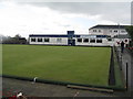
Glenmavis Bowling Club
On Torphichen Street, Bathgate.
Image: © M J Richardson
Taken: 23 Aug 2014
0.09 miles
5
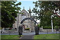
James Young Simpson memorial arch, Bathgate
Born in Bathgate, Simpson (https://en.wikipedia.org/wiki/James_Young_Simpson ) was a Scottish obstetrician who pioneered the use of chloroform as an anesthetic and was active in the Free Church. Behind is the former Marjoribanks Street Congregational (now United Reformed) Church; see its C-listing for details
(LB50608: http://portal.historicenvironment.scot/designation/LB50608 ).
Image: © Bill Harrison
Taken: 21 Jun 2018
0.12 miles
6
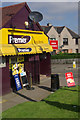
Raza Stores, Bathgate
Colourful convenience shop at the north end of Livery Street.
Image: © Stephen McKay
Taken: 7 Jun 2013
0.12 miles
7
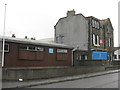
WW1 Drill Hall, Torphichen Street
This was a WW1 drill hall, the base of the 10th (Cyclist) Battalion, Royal Scots (C Company) http://www.geograph.org.uk/article/WW1-Great-War-Centenary---Drill-Halls/. It is still in use as a military building, for the Machine Gun Platoon, 6th Battalion, Royal Regiment of Scotland, and as an Army Reserve Centre and ATC Squadron.
Image: © M J Richardson
Taken: 23 Aug 2014
0.12 miles
8
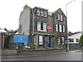
Army Reserve Centre, Bathgate
This was a WW1 drill hall, the base of the 10th (Cyclist) Battalion, Royal Scots (C Company) http://www.geograph.org.uk/article/WW1-Great-War-Centenary---Drill-Halls/. It is still in use as a military building, for the Machine Gun Platoon, 6th Battalion, Royal Regiment of Scotland, and as an Army Reserve Centre and ATC Squadron.
Image: © M J Richardson
Taken: 23 Aug 2014
0.12 miles
9
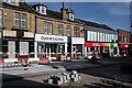
George Street
Work is in progress to lay new paving in George Street, which is fully pedestrianised. It is mainly occupied by the same chain shops as every other small town main street in the country.
Image: © Anne Burgess
Taken: 31 Aug 2010
0.14 miles
10
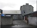
Bathgate WW1 Drill Hall
This was a WW1 drill hall, the base of the 10th (Cyclist) Battalion, Royal Scots (C Company) http://www.geograph.org.uk/article/WW1-Great-War-Centenary---Drill-Halls/. It is still in use as a military building, for the Machine Gun Platoon, 6th Battalion, Royal Regiment of Scotland, and as an Army Reserve Centre and ATC Squadron. This is a view from Athol Place showing the actual hall behind the main building.
Image: © M J Richardson
Taken: 23 Aug 2014
0.14 miles