
IMAGES TAKEN NEAR TO
Davie's Way, BATHGATE, EH48 3GN
Introduction
This page details the photographs taken nearby to Davie's Way, EH48 3GN by members of the Geograph project.
The Geograph project started in 2005 with the aim of publishing, organising and preserving representative images for every square kilometre of Great Britain, Ireland and the Isle of Man.

There are currently over 7.5m images from over14,400 individuals and you can help contribute to the project by visiting https://www.geograph.org.uk
Image Map
Images are licensed for reuse under creativecommons.org/licenses/by-sa/2.0
Notes
- Clicking on the map will re-center to the selected point.
- The higher the marker number, the further away the image location is from the centre of the postcode.
Image Listing (21 Images Found)
Images are licensed for reuse under creativecommons.org/licenses/by-sa/2.0
Image
Details
Distance
1

Grassland, Bathville
Meadows to the north of the Airdrie-Bathgate railway.
Image: © Richard Webb
Taken: 13 Jun 2008
0.04 miles
2

Keyhole sculpture
I walked through with an eye on the GPS to get an idea as to which square to assign it to. One of several sculptures along the disused (soon to reopen) railway between Airdrie and Bathgate.
Image: © Richard Webb
Taken: 13 Jun 2008
0.05 miles
3

New houses, Armadale
There is a lot of building going on in Armadale. A replacement cycle path , the old one was the railway trackbed, runs between the houses and railway.
Image: © Richard Webb
Taken: 24 Apr 2014
0.06 miles
4

Through the Keyhole
On the old trackbed of the Airdrie to Bathgate line just west of Armadale station is this keyhole-shaped sculpture, which you can walk or cycle through.
Image: © Raymond Okonski
Taken: 5 May 2007
0.07 miles
5

Former Railway Line at Bathville Armadale
Now part of cycle route 75 between Glasgow and Edinburgh former railway embankment can still be seen
Image: © paul birrell
Taken: 25 Jun 2005
0.08 miles
6

NCP 75 Armadale
Gorse starting to flower along the path Image
Image: © Jim Smillie
Taken: 7 Apr 2021
0.08 miles
7
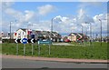
Capper's Roundabout, Armadale
Looking towards new houses on Kerr's Way.
Image: © Richard Webb
Taken: 24 Apr 2014
0.08 miles
8
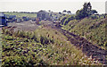
Armadale station (site/remains), 1991
View westward, towards Airdrie and Glasgow: ex-NBR Edinburgh - Bathgate - Glasgow line. The route was closed from 9/1/56 between Ratho (Bathgate Junction) and Airdrie to passenger services but they were restored to Bathgate from 3/3/86: Bathgate to Airdrie was closed to goods also from 19/7/65. Twenty-four years later on 12/12/10 the through route was restored, as an electrified line, from Bathgate to the North Clyde system at Drumgelloch (on a short extension from Airdrie opened in 5/89), providing a new, modern electrified route from Edinburgh through Glasgow to Helensburgh. In 1991, Armadale station was in this pathetic state.
Image: © Ben Brooksbank
Taken: 3 Sep 1991
0.10 miles
10

Armadale Station & Bridge
There is now no evidence of the station buildings or platforms, save for a scrapyard on the former station site. At this point platforms would have been on both sides of the trackbed, with the main building on the right, the Airdrie side of the track. Looking east, the Armadale to Whitburn road crosses the soon to be reopened Airdrie to Bathgate line. A service bus, heading to Armadale (from Whitburn) can be seen crossing a replacement bridge - the original being of a traditional stone 'arch' design to allow the trains to pass. This 1950's metal replacement removed the 'hump' for road users and lowered headroom to the removed trackbed beneath.
Image: © Raymond Okonski
Taken: 28 Apr 2007
0.12 miles