IMAGES TAKEN NEAR TO
South Street, BATHGATE, EH48 3EU
Introduction
This page details the photographs taken nearby to South Street, EH48 3EU by members of the Geograph project.
The Geograph project started in 2005 with the aim of publishing, organising and preserving representative images for every square kilometre of Great Britain, Ireland and the Isle of Man.

There are currently over 7.5m images from over14,400 individuals and you can help contribute to the project by visiting https://www.geograph.org.uk
Image Map
Images are licensed for reuse under creativecommons.org/licenses/by-sa/2.0
Notes
- Clicking on the map will re-center to the selected point.
- The higher the marker number, the further away the image location is from the centre of the postcode.
Image Listing (25 Images Found)
Images are licensed for reuse under creativecommons.org/licenses/by-sa/2.0
Image
Details
Distance
1

Hope Bridge Castle Masonic Lodge, South Street, Armadale
Dated 1906
Image: © Leslie Barrie
Taken: 4 May 2015
0.07 miles
2

High Academy Street, Armadale
Looking east to South Street (B8084), with James Street on the left and Mount Pleasant on the right. A 20mph speed limit, but thankfully no car-wrecking, passenger-wrecking, environmentally polluting humps.
Image: © M J Richardson
Taken: 23 Aug 2014
0.08 miles
3
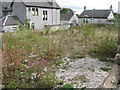
WW1 Drill Hall site, Armadale
On James Street, Armadale, this was the site of a WW1 drill hall of the 10th (Cyclist) Battalion, Royal Scots (C Company) http://www.geograph.org.uk/article/WW1-Great-War-Centenary---Drill-Halls/. It was later used as a Catholic chapel, and then as a builder's yard but burnt down in a fire that necessitated evacuation of houses on James Street and High Academy Street. It was demolished about 5 years ago. I was told that the shooting range had lead-lined walls to absorb bullets, and the value of lead recovered at demolition covered the cost of the site purchase.
Image: © M J Richardson
Taken: 23 Aug 2014
0.11 miles
4

Site of Drill Hall, Armadale
On James Street, Armadale, this was the site of a WW1 drill hall of the 10th (Cyclist) Battalion, Royal Scots (C Company) http://www.geograph.org.uk/article/WW1-Great-War-Centenary---Drill-Halls/. It was later used as a Catholic chapel, and then as a builder's yard but burnt down in a fire that necessitated evacuation of houses on James Street and High Academy Street. It was demolished about 5 years ago. I was told that the shooting range had lead-lined walls to absorb bullets, and the value of lead recovered at demolition covered the cost of the site purchase.
Image: © M J Richardson
Taken: 23 Aug 2014
0.12 miles
5
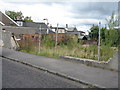
Remains of WW1 Drill Hall on High Academy Street
This was the site of a WW1 drill hall of the 10th (Cyclist) Battalion, Royal Scots (C Company) http://www.geograph.org.uk/article/WW1-Great-War-Centenary---Drill-Halls/. It was later used as a Catholic chapel, and then as a builder's yard but burnt down in a fire that necessitated evacuation of houses on James Street and High Academy Street. It was demolished about 5 years ago. I was told that the shooting range had lead-lined walls to absorb bullets, and the value of lead recovered at demolition covered the cost of the site purchase.
Image: © M J Richardson
Taken: 23 Aug 2014
0.13 miles
6

The Highlander Hotel, Armadale
On South Street.
Image: © JThomas
Taken: 11 Jul 2015
0.14 miles
7

Derelict school
At the top of Academy Street
Image: © Jim Smillie
Taken: 28 Apr 2021
0.16 miles

9

Armadale town centre
East Main Street, Armadale (A89). Taken while waiting to pull out of a residential side street. Note the yellow housebuilder's signs. West Lothian has the fastest growing population in any Scottish council area - building is slowing down now though.
Image: © Richard Webb
Taken: 9 Jan 2009
0.19 miles