
IMAGES TAKEN NEAR TO
Ochilview Square, BATHGATE, EH48 3EP
Introduction
This page details the photographs taken nearby to Ochilview Square, EH48 3EP by members of the Geograph project.
The Geograph project started in 2005 with the aim of publishing, organising and preserving representative images for every square kilometre of Great Britain, Ireland and the Isle of Man.

There are currently over 7.5m images from over14,400 individuals and you can help contribute to the project by visiting https://www.geograph.org.uk
Image Map
Images are licensed for reuse under creativecommons.org/licenses/by-sa/2.0
Notes
- Clicking on the map will re-center to the selected point.
- The higher the marker number, the further away the image location is from the centre of the postcode.
Image Listing (26 Images Found)
Images are licensed for reuse under creativecommons.org/licenses/by-sa/2.0
Image
Details
Distance
1

The Highlander Hotel, Armadale
On South Street.
Image: © JThomas
Taken: 11 Jul 2015
0.03 miles
2

Hope Bridge Castle Masonic Lodge, South Street, Armadale
Dated 1906
Image: © Leslie Barrie
Taken: 4 May 2015
0.06 miles
3

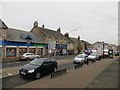
Armadale town centre
East Main Street, Armadale (A89). Taken while waiting to pull out of a residential side street. Note the yellow housebuilder's signs. West Lothian has the fastest growing population in any Scottish council area - building is slowing down now though.
Image: © Richard Webb
Taken: 9 Jan 2009
0.06 miles

7
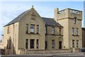
Former Miners' Welfare Institute, East Main Street, Armadale
Built 1923. Now converted for residential use.
Image: © Leslie Barrie
Taken: 4 May 2015
0.10 miles
8

High Academy Street, Armadale
Looking east to South Street (B8084), with James Street on the left and Mount Pleasant on the right. A 20mph speed limit, but thankfully no car-wrecking, passenger-wrecking, environmentally polluting humps.
Image: © M J Richardson
Taken: 23 Aug 2014
0.10 miles
9
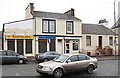
East Main Street, Armadale
Hairdressers and carryouts in Armadale.
Image: © Richard Webb
Taken: 9 Jan 2009
0.11 miles
10
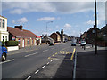
West Main Street, Armadale
View along the Main thoroughfare in this West Lothian Town, Armadale was founded on Heavy Industry such as Coal Mining, Limestone Quarrying and Brick making, all of which are gone now, Today it is mainly a commuter town roughly midway between Edinburgh and Glasgow and is close to the M8 Motorway.
Image: © Kevin Rae
Taken: 17 Apr 2006
0.11 miles