
IMAGES TAKEN NEAR TO
BATHGATE, EH48 3AR
Introduction
This page details the photographs taken nearby to EH48 3AR by members of the Geograph project.
The Geograph project started in 2005 with the aim of publishing, organising and preserving representative images for every square kilometre of Great Britain, Ireland and the Isle of Man.

There are currently over 7.5m images from over14,400 individuals and you can help contribute to the project by visiting https://www.geograph.org.uk
Image Map
Images are licensed for reuse under creativecommons.org/licenses/by-sa/2.0
Notes
- Clicking on the map will re-center to the selected point.
- The higher the marker number, the further away the image location is from the centre of the postcode.
Image Listing (7 Images Found)
Images are licensed for reuse under creativecommons.org/licenses/by-sa/2.0
Image
Details
Distance
1
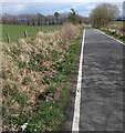
Roadside boundary
In front of the fence is an overgrown stone dyke
Image: © Jim Smillie
Taken: 28 Apr 2021
0.09 miles
2

Field edge, Hillhouse
A young shelter belt on high ground near Armadale.
Image: © Richard Webb
Taken: 31 Jan 2014
0.11 miles
3
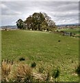
Copse: Nether Hillhouse
With a steep slope beyond
Image: © Jim Smillie
Taken: 28 Apr 2021
0.17 miles
4

Farm entrance: Over Hillhouse
Leading uphill to the farm steading
Image: © Jim Smillie
Taken: 28 Apr 2021
0.21 miles
5

Hillhouse BTS
This mobile phone Base Transmitting Station provides coverage for northern Armadale.
Image: © Raymond Okonski
Taken: 28 Apr 2007
0.21 miles
6
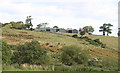
Nether Hillhouse
The farm buildings are at the top of the slope above the Mad Burn.
Image: © Anne Burgess
Taken: 25 Aug 2015
0.22 miles
7
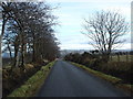
Country Lane, West Lothian
Near Westfield in an area of rolling countryside and not much else.
Image: © paul birrell
Taken: 2 Jan 2006
0.24 miles