
IMAGES TAKEN NEAR TO
Ferrier Crescent, BATHGATE, EH48 2PW
Introduction
This page details the photographs taken nearby to Ferrier Crescent, EH48 2PW by members of the Geograph project.
The Geograph project started in 2005 with the aim of publishing, organising and preserving representative images for every square kilometre of Great Britain, Ireland and the Isle of Man.

There are currently over 7.5m images from over14,400 individuals and you can help contribute to the project by visiting https://www.geograph.org.uk
Image Map
Images are licensed for reuse under creativecommons.org/licenses/by-sa/2.0
Notes
- Clicking on the map will re-center to the selected point.
- The higher the marker number, the further away the image location is from the centre of the postcode.
Image Listing (14 Images Found)
Images are licensed for reuse under creativecommons.org/licenses/by-sa/2.0
Image
Details
Distance
1
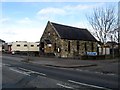
The Methodist Church in Scotland
The little church is situated on the A89 in the Mayfield district of Armadale in West Lothian.
Image: © James Denham
Taken: 20 Apr 2013
0.08 miles
2
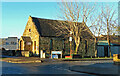
Armadale Methodist Church
Viewed in late-December sunshine.
Image: © Mary and Angus Hogg
Taken: 26 Dec 2023
0.08 miles
3
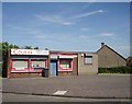
Mayfield
Shop in the eastern part of Armadale. Municipal housing estate built when there was a lot of heavy industry in the area.
Image: © Richard Webb
Taken: 2 Jun 2006
0.10 miles
4
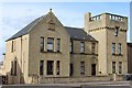
Former Miners' Welfare Institute, East Main Street, Armadale
Built 1923. Now converted for residential use.
Image: © Leslie Barrie
Taken: 4 May 2015
0.17 miles
5
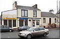
East Main Street, Armadale
Hairdressers and carryouts in Armadale.
Image: © Richard Webb
Taken: 9 Jan 2009
0.18 miles
6
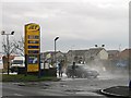
Working at the carwash
Not so joyful as the song on a cold January afternoon. Garage on the edge of Armadale with a big queue of cars waiting to be washed.
Image: © Richard Webb
Taken: 30 Jan 2009
0.20 miles
7
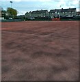
All purpose court
Recreation area behind McNeil crescent
Image: © Jim Smillie
Taken: 28 Apr 2021
0.21 miles
8

Armadale town centre
East Main Street, Armadale (A89). Taken while waiting to pull out of a residential side street. Note the yellow housebuilder's signs. West Lothian has the fastest growing population in any Scottish council area - building is slowing down now though.
Image: © Richard Webb
Taken: 9 Jan 2009
0.23 miles
9
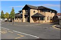
Armadale Group Practice
Medical Centre in North street, Armadale. Designed by Wheeler and Sproson Architects and completed circa 1995/1996.
Image: © Graeme Yuill
Taken: 15 Sep 2019
0.23 miles
