IMAGES TAKEN NEAR TO
Falside Crescent, BATHGATE, EH48 2DJ
Introduction
This page details the photographs taken nearby to Falside Crescent, EH48 2DJ by members of the Geograph project.
The Geograph project started in 2005 with the aim of publishing, organising and preserving representative images for every square kilometre of Great Britain, Ireland and the Isle of Man.

There are currently over 7.5m images from over14,400 individuals and you can help contribute to the project by visiting https://www.geograph.org.uk
Image Map
Images are licensed for reuse under creativecommons.org/licenses/by-sa/2.0
Notes
- Clicking on the map will re-center to the selected point.
- The higher the marker number, the further away the image location is from the centre of the postcode.
Image Listing (9 Images Found)
Images are licensed for reuse under creativecommons.org/licenses/by-sa/2.0
Image
Details
Distance
3
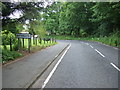
Falside
A housing scheme on the west side of Bathgate.
Image: © Richard Webb
Taken: 2 Jun 2006
0.14 miles
5
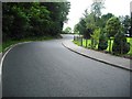
Sibbalds Brae
Leading from Bathgate to Armadale.
Image: © Jim Smillie
Taken: 29 Jul 2010
0.19 miles
8

Odd Seat off Plessey Road Entrance to Nature Park
I always think these areas of managed countryside should be called natural or wild parks. Little Boghead Nature Park sounds a bit grand, however nice it is! This is one of a few of these quirky wooden seats dotted about the park's paths - I rather like them but they do seem slightly antisocial, particularly as I didn't come across any benches.
Plessey Road and Plessey Terrace are two relatively new (ten years old or so) residential roads, situated off Factory Road, which leads to Whiteside Industrial Estate. It is called Factory Road because it used to lead to the Plessey capacitor, or condenser factory (capacitors used to be called condensers it seems), which until the 1980s occupied all of the land that now makes up the industrial estate.
The factory had a very interesting last few years. Built in 1947, it expanded rapidly, at one point employing a predominantly female workforce of around 2,000. There were several rounds of redundancies though the following decade, and eventually it was announced that the factory would close in 1982 with the loss of 300 or so jobs. Unions still held quite an influence back then and when the workforce found out that capacitor orders were still being placed, and that all of the Bathgate machinery was due to be collected and transported to another Plessey plant in Europe they took matters into their own hands.
Once the early shift's workforce had all arrived they shut the gates and took control of the premises, denying access to the management who started two hours later. They then staged an eight week sit-in, refusing to leave until they got assurances that management's decision would be overturned. Marches of 2,000+ people took to the streets, donations were made and the workforce got a victory, of sorts, in the end. Only a quarter of the jobs were held on to as Plessey bowed to the pressure and sold the factory on to new owners. It only really delayed the inevitable, though, as three years later it closed for good.
There are some good pictures on Facebook. It is interesting to see the women's work wear - health and safety was obviously still in its infancy then as they all seem to be going about their work wearing open-toed sandals!
Image: © Ian Dodds
Taken: 14 Feb 2021
0.25 miles