IMAGES TAKEN NEAR TO
Drum Brae Drive, EDINBURGH, EH4 7SH
Introduction
This page details the photographs taken nearby to Drum Brae Drive, EH4 7SH by members of the Geograph project.
The Geograph project started in 2005 with the aim of publishing, organising and preserving representative images for every square kilometre of Great Britain, Ireland and the Isle of Man.

There are currently over 7.5m images from over14,400 individuals and you can help contribute to the project by visiting https://www.geograph.org.uk
Image Map
Images are licensed for reuse under creativecommons.org/licenses/by-sa/2.0
Notes
- Clicking on the map will re-center to the selected point.
- The higher the marker number, the further away the image location is from the centre of the postcode.
Image Listing (10 Images Found)
Images are licensed for reuse under creativecommons.org/licenses/by-sa/2.0
Image
Details
Distance
1
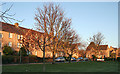
Drum Brae Drive
Drum Brae Drive is the heart of a big housing estate, but it has at intervals an enclave like this where the line of buildings is set back from the road with a small grassy area. These enclaves were still lit by the sun today, while the street itself was already in the shade.
Image: © Anne Burgess
Taken: 5 Dec 2012
0.03 miles
3
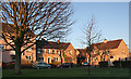
Drum Brae Drive
Drum Brae Drive is the heart of a big housing estate, but it has at intervals an enclave like this where the line of buildings is set back from the road with a small grassy area. These enclaves were still lit by the sun today, while the street itself was already in the shade.
Image: © Anne Burgess
Taken: 5 Dec 2012
0.14 miles
4
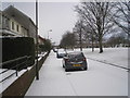
Morven Street in the snow
In Clermiston, a council scheme built in the late '50s and early '60s.
Image: © Charlotte Lunn
Taken: 11 Mar 2013
0.16 miles
5
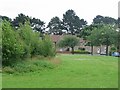
Clermiston
Large 20th century housing area on the west side of Corstorphine Hill. The once vare open area in the middle of the estate has been broken up by some tree planting.
Image: © Richard Webb
Taken: 16 Jul 2005
0.17 miles
6
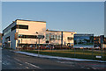
Drum Brae Community Centre
The sign on poles in the grass says that the centre, due to open in early 2012, contains the library. local council services, police, day care and facilities for adult with learning difficulties. Confusingly, a second sign points along Rannoch road to Rannoch Community Centre, which I think is its old name. It has made it on to the current online maps.
Image: © Anne Burgess
Taken: 5 Dec 2012
0.18 miles
8

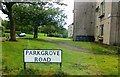
Shops on Duart Crescent, Drumbrae
A small parade of shops just off the B701.
Image: © michael ely
Taken: 22 Feb 2011
0.22 miles
9
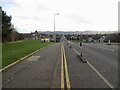
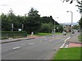
Top of the hill, Drum Brae
The summit of a short sharp road climb.
Image: © Richard Webb
Taken: 31 Jan 2022
0.23 miles