
IMAGES TAKEN NEAR TO
Quarry Road, BATHGATE, EH47 9HD
Introduction
This page details the photographs taken nearby to Quarry Road, EH47 9HD by members of the Geograph project.
The Geograph project started in 2005 with the aim of publishing, organising and preserving representative images for every square kilometre of Great Britain, Ireland and the Isle of Man.

There are currently over 7.5m images from over14,400 individuals and you can help contribute to the project by visiting https://www.geograph.org.uk
Image Map
Images are licensed for reuse under creativecommons.org/licenses/by-sa/2.0
Notes
- Clicking on the map will re-center to the selected point.
- The higher the marker number, the further away the image location is from the centre of the postcode.
Image Listing (8 Images Found)
Images are licensed for reuse under creativecommons.org/licenses/by-sa/2.0
Image
Details
Distance
1
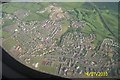
Fauldhouse, West Lothian
Taken from flight into Edinburgh Airport
Image: © paul birrell
Taken: 14 Jul 2003
0.12 miles

3

Fauldhouse & Crofthead railway station (site), Lothian
Opened as 'Crofthead' in 1845 by the Wilsontown, Morningside & Coltness Railway on the line that eventually ran to Bathgate, the station opened and closed sporadically over the years, closing finally to passengers in 1930. From 1906 to 1930 it was known as Fauldhouse & Crofthead.
View north east towards Longridge and Bathgate. The line ran to the right of the conifers with the single short platform being roughly where the conifers are, with sidings to the left. No trace apparently remains.
Image: © Nigel Thompson
Taken: 26 Nov 2016
0.21 miles
4

War Memorial, Fauldhouse
All four wall panels are filled with the names of the fallen in WW1. Most of them were young miners from the village. The panel at the base lists the fallen in WW2 and is in marked contract to the number of dead in WW1. The memorial was completely refurbished in early 2008. Even after some 90 years standing it is still an impressive structure.
Image: © John McLaughlin
Taken: 14 Jan 2009
0.22 miles
5

Timber-clad houses, Croftfoot Drive
A small circular estate on the eastern edge of Fauldhouse.
Image: © M J Richardson
Taken: 13 Sep 2021
0.22 miles
6

Greenburn Road
Clubhouse of Greenburn Golf Club on left
Image: © Jim Smillie
Taken: 9 Jul 2021
0.22 miles
7

Cottages: Bridge Street
Probably date from the late 19th century
Image: © Jim Smillie
Taken: 9 Jul 2021
0.24 miles
8
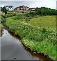
Flood plain beside Breich Water
Identified as Cadgers Home on old maps
Image: © Jim Smillie
Taken: 9 Jul 2021
0.25 miles