
IMAGES TAKEN NEAR TO
Fauldhouse, BATHGATE, EH47 9AD
Introduction
This page details the photographs taken nearby to EH47 9AD by members of the Geograph project.
The Geograph project started in 2005 with the aim of publishing, organising and preserving representative images for every square kilometre of Great Britain, Ireland and the Isle of Man.

There are currently over 7.5m images from over14,400 individuals and you can help contribute to the project by visiting https://www.geograph.org.uk
Image Map
Images are licensed for reuse under creativecommons.org/licenses/by-sa/2.0
Notes
- Clicking on the map will re-center to the selected point.
- The higher the marker number, the further away the image location is from the centre of the postcode.
Image Listing (10 Images Found)
Images are licensed for reuse under creativecommons.org/licenses/by-sa/2.0
Image
Details
Distance
1
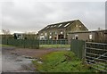
Conversion, Wayside
Former industrial building, now a home.
Image: © Richard Webb
Taken: 28 Jan 2007
0.01 miles
2
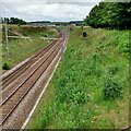
Next Stop: Breich Station
An unmanned station on Glasgow-Edinburgh via Shotts line
Image: © Jim Smillie
Taken: 9 Jul 2021
0.07 miles
3
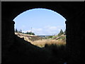
Mouldron West branch, Fauldhouse
The Mouldron West branch served ironstone pits on the Gladsmuir Hills, south of Fauldhouse, some houses of which can be seen in the distance. Leaving the Edinburgh - Shotts - Glasgow Central line 1.5km east of Fauldhouse station, within 300 metres it passed under the A71 main road, the bridge being used here to frame the railway cutting.
Image: © A-M-Jervis
Taken: 28 Apr 2007
0.09 miles
4
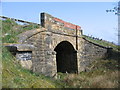
A71 bridge, Mouldron West branch, Fauldhouse
This bridge carries the A71 Edinburgh - Motherwell road over the course of the single-track Mouldron West branch about 300 metres south of the Edinburgh - Shotts - Glasgow line near Fauldhouse. The road now has crash barriers across the bridge but it would seem that before these were provided the parapets suffered from errant vehicles. One might also assume that the highways department found bricklayers easier to source than stonemasons.
Image: © A-M-Jervis
Taken: 28 Apr 2007
0.09 miles
5
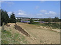
Mouldron West branch junction, Fauldhouse
The First ScotRail diesel unit is en route from Edinburgh to Glasgow via Shotts and is starting round the long S-bend across the Breich Water valley towards Fauldhouse. In the right foreground is the cutting at the start of the Mouldron West branch. This ran south and west for a little over a mile and connected with a series of tramways that served ironstone mines and quarries in the Gladsmuir Hills. The branch was probably constructed in the last quarter of the nineteenth century and went out of use before the Second World War.
Image: © A-M-Jervis
Taken: 28 Apr 2007
0.13 miles
6
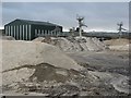
Levenseat Quarry
Mounds of silica sand, very pure sandstone that is nearly all silicon dioxide, await collection at the Levenseat Quarry road head.
The sand is sold for dressing of sports pitches, golf greens and to make molds for casting metals.
Image: © Richard Webb
Taken: 28 Jan 2007
0.15 miles
7
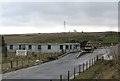
Entrance Levenseat Quarry
Road access to the silica quarry further up the hill.
Image: © Richard Webb
Taken: 28 Jan 2007
0.20 miles
8
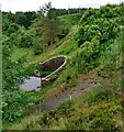
Tunnel entrance
The Breich Water emerges after passing under a railway embankment and the 3rd tee on Greenburn Golf Course
Image: © Jim Smillie
Taken: 9 Jul 2021
0.23 miles
9
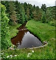
Breich Water
From the edge of the 3rd tee at Greenburn Golf Course
Image: © Jim Smillie
Taken: 9 Jul 2021
0.23 miles
10
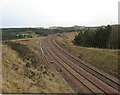
Embankment across the Breich Water
There are currently three rail routes between Edinburgh and Glasgow. This is the slow one running through what were coalfields to Glasgow Central. Big embankment south of Fauldhouse.
Image: © Richard Webb
Taken: 28 Jan 2007
0.24 miles