
IMAGES TAKEN NEAR TO
Glenalmond, BATHGATE, EH47 8NS
Introduction
This page details the photographs taken nearby to Glenalmond, EH47 8NS by members of the Geograph project.
The Geograph project started in 2005 with the aim of publishing, organising and preserving representative images for every square kilometre of Great Britain, Ireland and the Isle of Man.

There are currently over 7.5m images from over14,400 individuals and you can help contribute to the project by visiting https://www.geograph.org.uk
Image Map
Images are licensed for reuse under creativecommons.org/licenses/by-sa/2.0
Notes
- Clicking on the map will re-center to the selected point.
- The higher the marker number, the further away the image location is from the centre of the postcode.
Image Listing (12 Images Found)
Images are licensed for reuse under creativecommons.org/licenses/by-sa/2.0
Image
Details
Distance
1

Blaeberryhill Road
By-passes Whitburn town centre
Image: © Jim Smillie
Taken: 3 Aug 2020
0.06 miles
2

Blaeberryhill Inn
Behind trees, pub/restaurant in former farm buildings. Much of the land of this farm has been built on in the last 30/40years.
Image: © Jim Smillie
Taken: 14 Jan 2009
0.10 miles

4
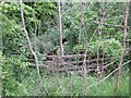
The White Burn at Whitburn
From which the town gets its name. Here it is hardly visible, obscured by dense vegetation in a deep valley as it passes under Blaeberryhill Road.
Image: © M J Richardson
Taken: 10 Jun 2021
0.17 miles
5

Fields off Blaeberry Hill Road
Grassland on the southern edge of Whitburn. The distant Pentland Hills had been snow covered at least in part for over two months.
Image: © Richard Webb
Taken: 11 Feb 2010
0.18 miles
6
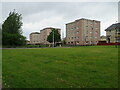
Blocks of flats at Whitburn
Three of four blocks overlooking White Burn and Blaeberry Hill.
Image: © M J Richardson
Taken: 10 Jun 2021
0.20 miles
7

Blaeberryhill
Blaeberryhill was a farm, now it's a Whitburn housing estate.
Image: © Richard Webb
Taken: 11 May 2006
0.21 miles
8
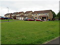
Houses at Glencoe, Whitburn
A small estate off Blaeberryhill Road.
Image: © M J Richardson
Taken: 10 Jun 2021
0.21 miles
9

Gleneagles Court
An estate about 20 years old named incorrectly (Emerson St.) on well known mapping websites with links on Geograph.
Image: © Jim Smillie
Taken: 3 Jan 2009
0.23 miles
10

Marshland
Area to north of Gleneagles Court estate.
Image: © Jim Smillie
Taken: 3 Jan 2009
0.23 miles