
IMAGES TAKEN NEAR TO
Glenburn Gardens, BATHGATE, EH47 8NL
Introduction
This page details the photographs taken nearby to Glenburn Gardens, EH47 8NL by members of the Geograph project.
The Geograph project started in 2005 with the aim of publishing, organising and preserving representative images for every square kilometre of Great Britain, Ireland and the Isle of Man.

There are currently over 7.5m images from over14,400 individuals and you can help contribute to the project by visiting https://www.geograph.org.uk
Image Map
Images are licensed for reuse under creativecommons.org/licenses/by-sa/2.0
Notes
- Clicking on the map will re-center to the selected point.
- The higher the marker number, the further away the image location is from the centre of the postcode.
Image Listing (14 Images Found)
Images are licensed for reuse under creativecommons.org/licenses/by-sa/2.0
Image
Details
Distance
1

Glenburn Path
Part of Whitburn path network
Image: © Jim Smillie
Taken: 3 Aug 2020
0.07 miles
2
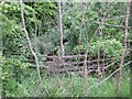
The White Burn at Whitburn
From which the town gets its name. Here it is hardly visible, obscured by dense vegetation in a deep valley as it passes under Blaeberryhill Road.
Image: © M J Richardson
Taken: 10 Jun 2021
0.07 miles
3
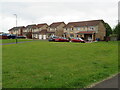
Houses at Glencoe, Whitburn
A small estate off Blaeberryhill Road.
Image: © M J Richardson
Taken: 10 Jun 2021
0.08 miles

5
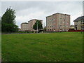
Blocks of flats at Whitburn
Three of four blocks overlooking White Burn and Blaeberry Hill.
Image: © M J Richardson
Taken: 10 Jun 2021
0.11 miles
6

Heathy Field in East Whitburn
This field and the one East of it have similar vegetation - rushy ground with several bushes dotted around. There were a handful of cows lolling around in both - a feature of West Lothian is that it is commonplace to see small herds grazing, each cow different to the next.
Image: © Ian Dodds
Taken: 18 Jun 2021
0.12 miles
7

Blaeberryhill Road
By-passes Whitburn town centre
Image: © Jim Smillie
Taken: 3 Aug 2020
0.13 miles
8

Glencoe
This is one of several estates in this grid square named incorrectly (Virginia Court) on a number of well known mapping websites linked with Geograph.
Image: © Jim Smillie
Taken: 3 Jan 2009
0.14 miles
9

Sign of spring
This small pond east of Glenburn Gardens formed in mining subsidence in Blaeberryhill Community Woodland.
Image: © Ian Murfitt
Taken: 17 Mar 2012
0.15 miles
10

Pond beside footpath
Looking towards Glenisla and Glenburn estates.
Image: © Jim Smillie
Taken: 19 Mar 2009
0.17 miles