
IMAGES TAKEN NEAR TO
Turnhigh Road, BATHGATE, EH47 8HU
Introduction
This page details the photographs taken nearby to Turnhigh Road, EH47 8HU by members of the Geograph project.
The Geograph project started in 2005 with the aim of publishing, organising and preserving representative images for every square kilometre of Great Britain, Ireland and the Isle of Man.

There are currently over 7.5m images from over14,400 individuals and you can help contribute to the project by visiting https://www.geograph.org.uk
Image Map
Images are licensed for reuse under creativecommons.org/licenses/by-sa/2.0
Notes
- Clicking on the map will re-center to the selected point.
- The higher the marker number, the further away the image location is from the centre of the postcode.
Image Listing (10 Images Found)
Images are licensed for reuse under creativecommons.org/licenses/by-sa/2.0
Image
Details
Distance

2

Open Space 2020
Opposite view to Image Between Netherton and Kepscaith houses.
Image: © Jim Smillie
Taken: 3 Aug 2020
0.15 miles
3
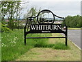
'Onward WHITBURN Welcomes You'
A rather attractive sign as one approaches Whitburn from the south on the A706.
Image: © M J Richardson
Taken: 10 Jun 2021
0.16 miles
4

Open Space
One of the few open spaces left between housing estates on the north side of Blaeberryhill Road
Image: © Jim Smillie
Taken: 14 Jan 2009
0.16 miles
5
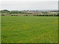
Buttercup field at Cairnie
Looking northwest over Whitburn.
Image: © M J Richardson
Taken: 10 Jun 2021
0.17 miles
6

A706: Blaeberryhill Junction
An amended plan was submitted June 2020 to build a link road opposite Blaeberryhill Road joining Polkemmet Road at Heartlands
Image: © Jim Smillie
Taken: 3 Aug 2020
0.18 miles

8
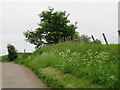
Lay-by with Cow Parsley
At Cairnie on the A706 south of Whitburn.
Image: © M J Richardson
Taken: 10 Jun 2021
0.21 miles
9

Cairnie farm
Pasture near Whitburn, from a lay-by off the A706 [Longridge Road].
Image: © M J Richardson
Taken: 10 Jun 2021
0.23 miles
10

Layby, Cairnie
An "oxbow" road, left behind when the A706 was straightened out. Now a farm access and parking area.
Image: © Richard Webb
Taken: 16 Jan 2015
0.24 miles