
IMAGES TAKEN NEAR TO
Burnlea Drive, BATHGATE, EH47 8DJ
Introduction
This page details the photographs taken nearby to Burnlea Drive, EH47 8DJ by members of the Geograph project.
The Geograph project started in 2005 with the aim of publishing, organising and preserving representative images for every square kilometre of Great Britain, Ireland and the Isle of Man.

There are currently over 7.5m images from over14,400 individuals and you can help contribute to the project by visiting https://www.geograph.org.uk
Image Map
Images are licensed for reuse under creativecommons.org/licenses/by-sa/2.0
Notes
- Clicking on the map will re-center to the selected point.
- The higher the marker number, the further away the image location is from the centre of the postcode.
Image Listing (17 Images Found)
Images are licensed for reuse under creativecommons.org/licenses/by-sa/2.0
Image
Details
Distance
1

Houses, Bents
A familiar West Lothian settlement pattern. The houses built on a circuit just off a main road, with no frontages onto the main road itself.
Image: © Richard Webb
Taken: 2 Oct 2008
0.08 miles
2

Chili Hut, Bents
Yellow fast food outlet in a linear mining village.
Image: © Richard Webb
Taken: 2 Oct 2008
0.10 miles
3

Shop, Bents
The usual uniform small shop. Bents is the western part of a linear mining community strung out along the Breich Water.
Image: © Richard Webb
Taken: 2 Oct 2008
0.12 miles
4

Postbox on Main Street, Stoneyburn
Postbox No. EH47 59.
Image: © JThomas
Taken: 17 Sep 2021
0.12 miles
5

Breich Water
Upstream from bridge on path network
Image: © Jim Smillie
Taken: 27 Aug 2021
0.12 miles
6
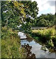
Overhanging oak tree
Beside a bridge over Breich Water
Image: © Jim Smillie
Taken: 27 Aug 2021
0.12 miles
7

Bents, West Lothian
The east end of this quite long village which grew due to the oil shale industry in the area.
Image: © Kevin Rae
Taken: 29 May 2006
0.13 miles
8

Bus stop and shelter on the B7015, Stoneyburn
Image: © JThomas
Taken: 17 Sep 2021
0.14 miles

10
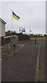
An Odd Collection of Flags
The only theory I can call me up with is that an Irish, a Japanese and an Australian share this house, and are showing their support for Ukraine in the current ongoing war. But maybe whoever lives here just likes flags.
I heard the other day that the Ukrainian flag symbolises a summer sky over fields of bright wheat. The Japanese one shows a rising sun, and the (it has to be said) rather aspirational Irish one symbolises Catholics and Protestants meeting in peace.
The Australian one required some research. The Union Jack at the top left (unfortunately the wind has blown the flag round so it is facing the wrong way, and one of its stars is hard to spot due to it billowing around) obviously is a reference to its roots as a British colony, although this is more to do with the majority of its citizens having descended from British settlers rather than any particular pride in the Empire. The cross beneath it gets called the 'Commonwealth Star'; this seems to be referring to the common wealth of Australia, as opposed to the Commonwealth as we know it generally though, as six of the stars' points apparently represent the country's six states and the seventh their combining to form one overall state. The five stars on the right symbolise its geographic location, and represent a constellation only seen in the night skies of the Southern Hemisphere: the 'Southern Cross'. The original flag was actually a bit better I think. All of the five stars had different numbers of points to represent their relative brightnesses in the sky; today all bar a tiddly five-pointer are the same.
Image: © Ian Dodds
Taken: 2 May 2022
0.15 miles