
IMAGES TAKEN NEAR TO
Rowan Drive, BATHGATE, EH47 7QE
Introduction
This page details the photographs taken nearby to Rowan Drive, EH47 7QE by members of the Geograph project.
The Geograph project started in 2005 with the aim of publishing, organising and preserving representative images for every square kilometre of Great Britain, Ireland and the Isle of Man.

There are currently over 7.5m images from over14,400 individuals and you can help contribute to the project by visiting https://www.geograph.org.uk
Image Map
Images are licensed for reuse under creativecommons.org/licenses/by-sa/2.0
Notes
- Clicking on the map will re-center to the selected point.
- The higher the marker number, the further away the image location is from the centre of the postcode.
Image Listing (10 Images Found)
Images are licensed for reuse under creativecommons.org/licenses/by-sa/2.0
Image
Details
Distance
1
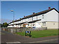
Rowan Drive, Blackburn
One of many short terraces of houses on the northeast edge of Blackburn.
Image: © M J Richardson
Taken: 5 Sep 2018
0.10 miles
2

Rowan Drive, Blackburn
A housing estate on the eastern edge of the village.
Image: © M J Richardson
Taken: 5 Sep 2018
0.13 miles
3

Rowan Drive Blackburn
Variety of housing types. Like much of West Lothian the pavements are covered in grit spread during severe weather in December/January.
Image: © Jim Smillie
Taken: 7 Mar 2011
0.13 miles
4
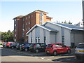
Murrayfield House, Blackburn
One of two blocks of flats that are part of the Council’s Homeless Management Programme [the other, Mossview, is just out of view on the right]. They are connected by the new grey building, which is the Rowan Drive Homeless Persons Unit.
Image: © M J Richardson
Taken: 5 Sep 2018
0.14 miles
5

Path: Easter Inch Moss
Flats of Blackburn visible over trees.
Image: © Jim Smillie
Taken: 7 Mar 2011
0.15 miles
6
NCN75 at Blackburn
Leaving Easter Inch Moss for Elm Terrace.
Image: © M J Richardson
Taken: 5 Sep 2018
0.17 miles
7
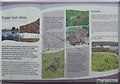
Easter Inch Moss information board
At the western entrance to the National Nature Reserve on Elm Terrace, Blackburn.
Image: © M J Richardson
Taken: 5 Sep 2018
0.19 miles
8

Blackburn
The boulders are typical of the ones that lie about the hills near here.
Image: © Richard Webb
Taken: 11 Mar 2008
0.20 miles
9
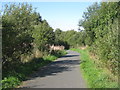
NCN75 at Easter Inch Moss
Looking west along the cycle and footpath from Livingston through Easter Inch Moss to Blackburn.
Image: © M J Richardson
Taken: 5 Sep 2018
0.21 miles
10
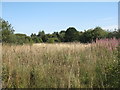
Easter Inch Moss, Blackburn
A lowland raised bog which is being managed to recover from past drainage. A National and Local Nature Reserve and an important wetland habitat.
Image: © M J Richardson
Taken: 5 Sep 2018
0.25 miles