
IMAGES TAKEN NEAR TO
Loch Fyne Way, BATHGATE, EH47 0RX
Introduction
This page details the photographs taken nearby to Loch Fyne Way, EH47 0RX by members of the Geograph project.
The Geograph project started in 2005 with the aim of publishing, organising and preserving representative images for every square kilometre of Great Britain, Ireland and the Isle of Man.

There are currently over 7.5m images from over14,400 individuals and you can help contribute to the project by visiting https://www.geograph.org.uk
Image Map
Images are licensed for reuse under creativecommons.org/licenses/by-sa/2.0
Notes
- Clicking on the map will re-center to the selected point.
- The higher the marker number, the further away the image location is from the centre of the postcode.
Image Listing (9 Images Found)
Images are licensed for reuse under creativecommons.org/licenses/by-sa/2.0
Image
Details
Distance
1
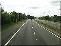
The M8 passing Whitburn
Heading east towards Glasgow.
Image: © M J Richardson
Taken: 24 Aug 2013
0.14 miles
2

One-O-Eight Hotel
Hotel on the eastern outskirts of Whitburn
Image: © James Allan
Taken: 10 Apr 2006
0.16 miles
3

March Fence
Boundary marked by stone dyke, fence and line of beech trees.
Image: © Jim Smillie
Taken: 13 Jan 2009
0.18 miles
4

White Burn flows under M8
Shortly before it meets the Almond.
Image: © Jim Smillie
Taken: 13 Jan 2009
0.19 miles
5

Bridge over White Burn
Built to link a system of footpaths.
Image: © Jim Smillie
Taken: 13 Jan 2009
0.21 miles
6

M8 eastbound nears Junction 4 at Whitburn
Image: © Colin Pyle
Taken: 5 Jun 2013
0.22 miles
7

Glencoe
This is one of several estates in this grid square named incorrectly (Virginia Court) on a number of well known mapping websites linked with Geograph.
Image: © Jim Smillie
Taken: 3 Jan 2009
0.22 miles
8

White Burn joining the River Almond
Until recently I had always assumed that the small town of Whitburn took its name from a description of the River Almond, which, while really more of a large stream at this point, is still by far the largest watercourse in its vicinity. What did strike me as odd though, was that the slightly smaller town of Blackburn, a couple of miles East along the same road, and sitting even closer to the Almond, has a diametrically opposite name.
It seems fairly certain that Blackburn takes its name from a description of the River Almond, as the old village sat very close to its banks, and there is no Black Burn nearby. Whitburn, however, would appear to have taken its name from this not-at-all white burn on the right of the picture. I do still have slight doubts due to its small size and the fact that the old village of Whitburn, which was formerly just a row of houses East and West of its central crossroads, was quite a bit closer to the river than the burn. However, old maps show that the old church was sited right next to White Burn, which changes its name from Mole's Burn (or Cultrig Burn depending on the age of the map) at that point, so the White Burn theory seems most likely.
The village of East Whitburn also sits very close to White Burn, so its name might not actually be referencing its position with regard to its larger neighbour, as is commonly assumed, but just from a description of the burn at that point.
The high embankments on both sides of the Almond around here look to be man-made, no doubt to mitigate the impact of flooding on the surrounding farmland.
Image: © Ian Dodds
Taken: 8 Jan 2022
0.25 miles
9

Main Street, East Whitburn
View westwards, past the Gothenburg (community public house) which is for sale.
Image: © Richard Webb
Taken: 21 Apr 2010
0.25 miles