
IMAGES TAKEN NEAR TO
Broomlee Road, WEST LINTON, EH46 7EJ
Introduction
This page details the photographs taken nearby to Broomlee Road, EH46 7EJ by members of the Geograph project.
The Geograph project started in 2005 with the aim of publishing, organising and preserving representative images for every square kilometre of Great Britain, Ireland and the Isle of Man.

There are currently over 7.5m images from over14,400 individuals and you can help contribute to the project by visiting https://www.geograph.org.uk
Image Map
Images are licensed for reuse under creativecommons.org/licenses/by-sa/2.0
Notes
- Clicking on the map will re-center to the selected point.
- The higher the marker number, the further away the image location is from the centre of the postcode.
Image Listing (102 Images Found)
Images are licensed for reuse under creativecommons.org/licenses/by-sa/2.0
Image
Details
Distance
1

Station Road, West Linton
The railway station was about 1 mile SE of the village at Broomlee, on the Leadburn & Dolphinton Branch of the North British Railway. The B7059 from the village is still known as Station Road. See also Ben Brooksbank's photograph Image for more about the station site.
Image: © Jim Barton
Taken: 30 Nov 2017
0.05 miles
2
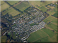
West Linton from the air
West Linton Primary School is prominent in the centre of the village.
See also Image
Image: © Thomas Nugent
Taken: 7 Feb 2020
0.06 miles
3
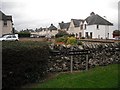
Broomlee Crescent
Residential street in West Linton.
Image: © Richard Webb
Taken: 27 Sep 2009
0.07 miles
4

Entering West Linton
Completing part of my walking link of Kirk Yetholm (Pennine Way) with Milngavie (West Highland Way). A bus from here takes me back to Peebles
Image: © Tim Heaton
Taken: 21 Jul 2017
0.08 miles
5

West Linton from the air
The course of Lyne Water can be seen as can in the lower left corner.
See also Image
Image: © Thomas Nugent
Taken: 7 Feb 2020
0.09 miles
6

Bridge, Bogsbank Road
Bridge over the Lyne Water, West Linton.
Image: © Richard Webb
Taken: 25 Jan 2012
0.09 miles
7
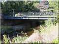
Bridge, West Linton
Bogsbank Road crosses the Lyne Water. There was a singing dipper beneath the bridge.
Image: © Richard Webb
Taken: 7 Sep 2014
0.09 miles
8

Electric vehicle charging points, West Linton
Two charging spaces on the B7059 in the village.
Image: © Jim Barton
Taken: 13 May 2021
0.09 miles
9

West Linton fire station
Gates a bit of a hindrance for emergency situation.
Image: © Jim Smillie
Taken: 25 May 2009
0.09 miles
10

Road bridge, West Linton
The bridge on Bogsbank Road over the Lyne Water.
Image: © Jim Barton
Taken: 27 Jun 2018
0.10 miles