
IMAGES TAKEN NEAR TO
Station Road, WEST LINTON, EH46 7BT
Introduction
This page details the photographs taken nearby to Station Road, EH46 7BT by members of the Geograph project.
The Geograph project started in 2005 with the aim of publishing, organising and preserving representative images for every square kilometre of Great Britain, Ireland and the Isle of Man.

There are currently over 7.5m images from over14,400 individuals and you can help contribute to the project by visiting https://www.geograph.org.uk
Image Map
Images are licensed for reuse under creativecommons.org/licenses/by-sa/2.0
Notes
- Clicking on the map will re-center to the selected point.
- The higher the marker number, the further away the image location is from the centre of the postcode.
Image Listing (10 Images Found)
Images are licensed for reuse under creativecommons.org/licenses/by-sa/2.0
Image
Details
Distance
1

Pasture at Broomlee
Looking north from the entrance to Broomlee Camp.
Image: © M J Richardson
Taken: 28 Feb 2016
0.00 miles

3

B7059 southeast of West Linton
The school sign refers to the entrance to the Broomlee Outdoor Centre a short way down the road.
Image: © Jim Barton
Taken: 30 Nov 2017
0.09 miles


6

Fields near West Linton from the air
Square fields to the south east of the village. The course of the former North British Railway's Dolphinton Branch line can be seen in the lower right corner.
Image: © Thomas Nugent
Taken: 7 Feb 2020
0.15 miles
7
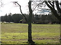
Broomlee Outdoor Centre, West Linton
One of three - the others are at Strathmore, Perthshire and Dounans in the Loch Lomond National Park. http://www.soec.org.uk/
Image: © M J Richardson
Taken: 28 Feb 2016
0.17 miles
8

Broomlee Centre.
Outdoor Education centre set in wooded parkland. One of the activity sites.
Image: © Richard Webb
Taken: 23 Nov 2005
0.18 miles
9

Site of Broomlee (for West Linton) Station
View westward, towards Dolphinton, the station having been behind bushes on right; ex-North British Leadburn - Dolphinton branch, which closed to passengers back on 1/4/33 (completely from here on to Dolphinton) and to goods a few years later.
Image: © Ben Brooksbank
Taken: 18 Sep 1974
0.20 miles
10

Sheep on Fir Knowe
A misty, frosty morning.
Image: © M J Richardson
Taken: 28 Feb 2016
0.25 miles