
IMAGES TAKEN NEAR TO
Silverknowes Crescent, EDINBURGH, EH4 5JD
Introduction
This page details the photographs taken nearby to Silverknowes Crescent, EH4 5JD by members of the Geograph project.
The Geograph project started in 2005 with the aim of publishing, organising and preserving representative images for every square kilometre of Great Britain, Ireland and the Isle of Man.

There are currently over 7.5m images from over14,400 individuals and you can help contribute to the project by visiting https://www.geograph.org.uk
Image Map
Images are licensed for reuse under creativecommons.org/licenses/by-sa/2.0
Notes
- Clicking on the map will re-center to the selected point.
- The higher the marker number, the further away the image location is from the centre of the postcode.
Image Listing (59 Images Found)
Images are licensed for reuse under creativecommons.org/licenses/by-sa/2.0
Image
Details
Distance
1

Silverknowes Drive
The outer of the three concentric near circles of the Silverknowes housing development. The rings are centred on the site of Silverknowes farm.
Image: © Richard Webb
Taken: 4 Oct 2019
0.07 miles
2
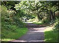
Cyclepath near Davidson's Mains
The path follows the route of the former branch line to Barnton, and emerges round the corner at a Tesco supermarket on Cramond Road South.
Image: © Jim Barton
Taken: 22 Sep 2016
0.10 miles
3
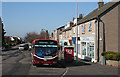
Silverknowes Road
A No 29 bus prepares to set off from its northern terminus beside the shops in Silverknowes Road.
Image: © Anne Burgess
Taken: 27 Mar 2012
0.11 miles
4
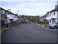
Silverknowes Terrace
Street at the western edge of the suburb of Silverknowes.
Image: © Callum Black
Taken: 14 Oct 2007
0.12 miles
5
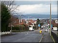
Silverknowes Road
Bisecting the concentric circles of Silverknowes. With a fine view down to the Firth of Forth.
Image: © Christine Johnstone
Taken: 5 Feb 2014
0.12 miles
6
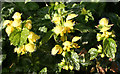
Yellow Archangel (Lamiastrum galeobdolon)
Related to mint and to the dead-nettles, this is subspecies L galeobdolon argentatum, with silvery variegation on its leaves. There is a whole bank of it in full bloom, a month earlier than its normal flowering time.
Image: © Anne Burgess
Taken: 29 Mar 2012
0.13 miles
7
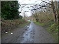
Footpath to Tesco's car park
The route of the former railway line to Barnton, opened in 1894. The line itself was on the embankment [right / north]. It crossed Cramond Road South by a bridge.
Image: © Christine Johnstone
Taken: 5 Feb 2014
0.13 miles

9

Smart Building
Modern buildings don't look so bad when they are not built right next to traditional ones. This one is the headquarters of J Smart and Company, building and civil engineering contractors.
Image: © Anne Burgess
Taken: 3 Apr 2011
0.13 miles
