
IMAGES TAKEN NEAR TO
Silverknowes Avenue, EDINBURGH, EH4 5HW
Introduction
This page details the photographs taken nearby to Silverknowes Avenue, EH4 5HW by members of the Geograph project.
The Geograph project started in 2005 with the aim of publishing, organising and preserving representative images for every square kilometre of Great Britain, Ireland and the Isle of Man.

There are currently over 7.5m images from over14,400 individuals and you can help contribute to the project by visiting https://www.geograph.org.uk
Image Map
Images are licensed for reuse under creativecommons.org/licenses/by-sa/2.0
Notes
- Clicking on the map will re-center to the selected point.
- The higher the marker number, the further away the image location is from the centre of the postcode.
Image Listing (81 Images Found)
Images are licensed for reuse under creativecommons.org/licenses/by-sa/2.0
Image
Details
Distance
1
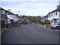
Silverknowes Terrace
Street at the western edge of the suburb of Silverknowes.
Image: © Callum Black
Taken: 14 Oct 2007
0.04 miles

3
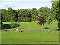
Lauriston Castle
The grounds, now owned and maintained by the City of Edinburgh Council.
Image: © Richard Webb
Taken: 27 Jun 2007
0.08 miles
4
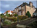
Houses on Cramond Road South
On the east side.
Image: © Christine Johnstone
Taken: 5 Feb 2014
0.09 miles
5

Offices, Davidson's Mains
Office building on Cramond Road South, opposite the end of Barton Avenue.
The Barnton Branch railway (which closed in 1951) ran just to the south of the site of this office building.
Image: © Callum Black
Taken: 14 Oct 2007
0.09 miles
6
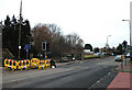
Sustrans Cycle Route 1, Davidson's Mains
This is where the cycle route crosses Cramond Road South. The blue fingerpost points the way through suburbia.
Image: © michael ely
Taken: 22 Feb 2011
0.10 miles
7

Path, Davidsons Mains
Used by the National Cycle Network.
Image: © Richard Webb
Taken: 10 Jan 2016
0.10 miles
8
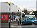
Tesco, Davidson's Mains
Considered a bit of a giant when it first opened as Safeway in the 1980s, this supermarket only makes "Metro" status under the Tesco brand today.
Image: © Callum Black
Taken: 16 Dec 2007
0.10 miles
9
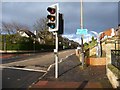
National cycle route 1 at Cramond Road South
Crossing on the level. The old railway bridge has long gone.
Image: © Christine Johnstone
Taken: 5 Feb 2014
0.10 miles
10

Cramond Road South
Passing Laurieston Castle.
Image: © Richard Webb
Taken: 22 Oct 2024
0.10 miles