
IMAGES TAKEN NEAR TO
Corbiehill Road, EDINBURGH, EH4 5DZ
Introduction
This page details the photographs taken nearby to Corbiehill Road, EH4 5DZ by members of the Geograph project.
The Geograph project started in 2005 with the aim of publishing, organising and preserving representative images for every square kilometre of Great Britain, Ireland and the Isle of Man.

There are currently over 7.5m images from over14,400 individuals and you can help contribute to the project by visiting https://www.geograph.org.uk
Image Map
Images are licensed for reuse under creativecommons.org/licenses/by-sa/2.0
Notes
- Clicking on the map will re-center to the selected point.
- The higher the marker number, the further away the image location is from the centre of the postcode.
Image Listing (59 Images Found)
Images are licensed for reuse under creativecommons.org/licenses/by-sa/2.0
Image
Details
Distance
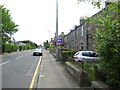
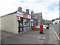
3
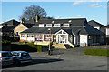
Davidson's Mains Parish Church Hall (1)
At first glance this, with its windows decorated with lettering reading 'undefeated champion' looks like a school. However I am informed that the parish church has two halls, of which this is one. See Image
Image: © Anne Burgess
Taken: 3 Apr 2011
0.10 miles
4
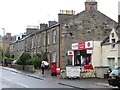
D-Mains Post Office
Davidson's Mains' post office on Corbiehill Road.
Image: © Richard Webb
Taken: 5 Sep 2014
0.10 miles
5

Bungalows on Vivian Terrace
Or are they called something else in Scotland?
"Och, they'll just be wee But an' Bens!" came the reply. See http://en.wikipedia.org/wiki/But_and_ben
Image: © Christine Johnstone
Taken: 18 Jan 2011
0.11 miles

7
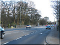
Hillhouse Road
I have always thought of the whole of the A90 as being Queensferry Road, because it is the main road out of Edinburgh towards Queensferry and the Forth Road Bridge. However on consulting the map I see that this section of it is in fact part of Hillhouse Road.
Image: © Anne Burgess
Taken: 3 Apr 2011
0.12 miles
8
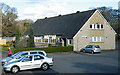
Davidson's Mains Parish Church Hall (2)
See Image This is the second of the two halls belonging to Davidson's Mains Parish Church. Apparently both halls are well used by the community.
Image: © Anne Burgess
Taken: 3 Apr 2011
0.12 miles
9
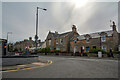
Cramond : Corbiehill Road
Looking off Ferry Road.
Image: © Lewis Clarke
Taken: 23 Sep 2020
0.13 miles
10
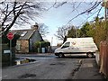
Junction on Main Street
Silverknowes Dell meets Silverknowes Road South.
Image: © Christine Johnstone
Taken: 18 Jan 2011
0.13 miles