
IMAGES TAKEN NEAR TO
Main Street, EDINBURGH, EH4 5BZ
Introduction
This page details the photographs taken nearby to Main Street, EH4 5BZ by members of the Geograph project.
The Geograph project started in 2005 with the aim of publishing, organising and preserving representative images for every square kilometre of Great Britain, Ireland and the Isle of Man.

There are currently over 7.5m images from over14,400 individuals and you can help contribute to the project by visiting https://www.geograph.org.uk
Image Map
Images are licensed for reuse under creativecommons.org/licenses/by-sa/2.0
Notes
- Clicking on the map will re-center to the selected point.
- The higher the marker number, the further away the image location is from the centre of the postcode.
Image Listing (64 Images Found)
Images are licensed for reuse under creativecommons.org/licenses/by-sa/2.0
Image
Details
Distance
1
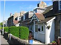
Cottages, Davidson's Mains
"D-Mains" is a village now swallowed up by Edinburgh, but retaining a village atmosphere. It is home to Scotland's oldest school, The Royal High School. The main street is a mixture of pubs, local shops and small cottages like these.
Image: © Richard Webb
Taken: 15 May 2005
0.01 miles
2
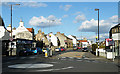
Davidson's Mains
This is the centre of what must originally have been a separate village, now a suburb of Edinburgh.
Image: © Anne Burgess
Taken: 3 Apr 2011
0.02 miles
3
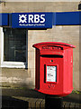
Letter Box at Davidson's Mains
This letter box stands conveniently outside the Royal Bank of Scotland, beside the bus stop in the supermarket car park.
Image: © Anne Burgess
Taken: 3 Apr 2011
0.04 miles
4
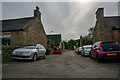
Cramond : Quality Street Lane
Looking off Main Street.
Image: © Lewis Clarke
Taken: 23 Sep 2020
0.04 miles
5
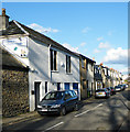
Quality Street Lane
This lane is at right angles to Quality Street.
Image: © Anne Burgess
Taken: 3 Apr 2011
0.04 miles
6

Davidson's Mains
From the grounds of the Church of the Holy Cross, the main road junction at Davidson's Mains takes on an almost village aspect.
Image: © Anne Burgess
Taken: 3 Apr 2011
0.04 miles
7

Davidson's Mains, Edinburgh
Junction of Quality Street and Main Street.
Image: © Mike Pennington
Taken: 10 Jun 2013
0.05 miles
8

Davidson's Mains
The end of East Barnton Gardens is flanked by a pair of round pillars. This is looking between the pillars to the mini-roundabout at the end of Main Street in Davidson's Mains. The route between the pillars (the original Queensferry Road) is the original turnpike road from Edinburgh to the crossing of the River Forth. The road was moved in the 1820s and the large wall which encompasses what was then the Barnton estate of the Ramsay family was built, going right around and down to Cramond area.
Thanks to Mike Richardson and Eunice Smith for help with the description.
Image: © Anne Burgess
Taken: 3 Apr 2011
0.05 miles
9
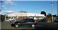
Davidson's Mains Tesco
This Tesco Metro is in the latest of several incarnations. I remember it as a Safeway, and I'm sure it has traded under other names as well. Whatever its name, it saves local residents a longish trip to any of the big supermarkets.
Image: © Anne Burgess
Taken: 3 Apr 2011
0.05 miles
10
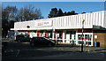
Davidson's Mains Tesco
This Tesco Metro is in the latest of several incarnations. I remember it as a Safeway, and I'm sure it has traded under other names as well. Whatever its name, it saves local residents a longish trip to any of the big supermarkets.
Image: © Anne Burgess
Taken: 3 Apr 2011
0.05 miles