
IMAGES TAKEN NEAR TO
Davidson Gardens, EDINBURGH, EH4 5AH
Introduction
This page details the photographs taken nearby to Davidson Gardens, EH4 5AH by members of the Geograph project.
The Geograph project started in 2005 with the aim of publishing, organising and preserving representative images for every square kilometre of Great Britain, Ireland and the Isle of Man.

There are currently over 7.5m images from over14,400 individuals and you can help contribute to the project by visiting https://www.geograph.org.uk
Image Map
Images are licensed for reuse under creativecommons.org/licenses/by-sa/2.0
Notes
- Clicking on the map will re-center to the selected point.
- The higher the marker number, the further away the image location is from the centre of the postcode.
Image Listing (46 Images Found)
Images are licensed for reuse under creativecommons.org/licenses/by-sa/2.0
Image
Details
Distance
1

Main Street bridge
Crossing Blackhall path, once the railway line to Cramond.
Image: © Christine Johnstone
Taken: 5 Feb 2014
0.04 miles
2

Bungalows on Vivian Terrace
Or are they called something else in Scotland?
"Och, they'll just be wee But an' Bens!" came the reply. See http://en.wikipedia.org/wiki/But_and_ben
Image: © Christine Johnstone
Taken: 18 Jan 2011
0.04 miles
3
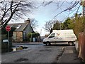
Junction on Main Street
Silverknowes Dell meets Silverknowes Road South.
Image: © Christine Johnstone
Taken: 18 Jan 2011
0.07 miles
4

Cycleway from Main Street bridge
A former railway running towards Haymarket.
Image: © Christine Johnstone
Taken: 18 Jan 2011
0.10 miles
5

Road Junction on Ferry Road, B9085, near Drylaw, Edinburgh
The B9085 continues to the left as Main Street and leads to Davidson's Mains. The road to the right is Silverknowes Road and heads in the general direction of the Firth of Forth leading to Silverknowes.
Image: © G Laird
Taken: 2 May 2017
0.10 miles
6

Silverknowes Road East
Parallel with Ferry Road for a short while.
Image: © Richard Webb
Taken: 22 Oct 2024
0.11 miles
7

Ferry Road
The western end, looking towards Davidson's Mains.
Image: © Richard Webb
Taken: 22 Oct 2024
0.12 miles
8

Silverknowes Midway
Silverknowes is a large estate of mainly detached mid-20th century houses. All the streets are named Silverknowes with a variety of second names - this is Silverknowes Midway.
Image: © Anne Burgess
Taken: 29 Mar 2012
0.12 miles
9
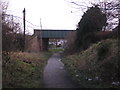
Bridge over former railway line
A road bridge over the former Craigleith to Davidson's Mains railway line.
Image: © Sandy Gemmill
Taken: 24 Jan 2009
0.12 miles
10

Silverknowes Road bridge
Crossing the former railway line to Barnton, opened in 1894. Now a footpath to a Tesco car park.
Image: © Christine Johnstone
Taken: 5 Feb 2014
0.12 miles