
IMAGES TAKEN NEAR TO
Crookston Place, PEEBLES, EH45 9AL
Introduction
This page details the photographs taken nearby to Crookston Place, EH45 9AL by members of the Geograph project.
The Geograph project started in 2005 with the aim of publishing, organising and preserving representative images for every square kilometre of Great Britain, Ireland and the Isle of Man.

There are currently over 7.5m images from over14,400 individuals and you can help contribute to the project by visiting https://www.geograph.org.uk
Image Map
Images are licensed for reuse under creativecommons.org/licenses/by-sa/2.0
Notes
- Clicking on the map will re-center to the selected point.
- The higher the marker number, the further away the image location is from the centre of the postcode.
Image Listing (56 Images Found)
Images are licensed for reuse under creativecommons.org/licenses/by-sa/2.0
Image
Details
Distance
1
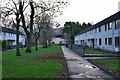
Crookston Place, Peebles
Part of the large expansion of housing in the Kingsmeadows area built in the days when growth of the textile industry increased the demand for accommodation.
Image: © Jim Barton
Taken: 21 Dec 2015
0.01 miles
2

Witchwood Crescent, Peebles
A residential area on the Kingsmeadows site south of the Tweed.
Image: © Jim Barton
Taken: 24 Nov 2018
0.05 miles
3

Path from Witchwood Crescent, Peebles
The path runs between the site of the former hill fort and Priorsford Primary School.
Image: © Jim Barton
Taken: 18 Aug 2013
0.06 miles
4
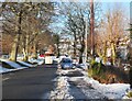
Snow at Glen Road, Peebles
A clear road but piled-up snow remains by the side, following falls on the 20th and 21st January.
Image: © Jim Barton
Taken: 22 Jan 2021
0.06 miles
5

Residential area, Kingsmeadows Peebles
Looking across Witchwood Crescent towards Cademuir Drive.
Image: © Jim Barton
Taken: 16 Dec 2017
0.07 miles
6
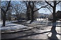
Sunlight and snow, Glen Road Peebles
A thin covering of snow after an overnight fall, seen from the junction of Witchwood Road and Glen Road.
Image: © Jim Barton
Taken: 7 Mar 2016
0.08 miles
7
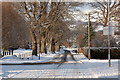
Glen Road, Peebles
Relatively recent housing developments to the left with slightly older properties to the right. Seen here after late November snowfall brought in by easterly winds.
Image: © Jim Barton
Taken: 28 Nov 2010
0.08 miles
8

Hill Fort site at Kingsmeadows, Peebles
This rocky knoll is a hill fort site, though little can be seen especially in summer when it's obscured by the dense growth of trees and scrub. It is an odd little island of wilder country surrounded by well-kept houses and a school.
Image: © Jim Barton
Taken: 21 Dec 2009
0.09 miles
9

The white deer reappears, Peebles
The white deer sculpture last seen on the island next to Tweed Bridge - Image - has reappeared in a less precarious location, in a garden not far from Priorsford Primary School.
Image: © Jim Barton
Taken: 15 Nov 2020
0.10 miles
10

Gallow Hill, Peebles
A residential area on the south side of the town, with Hamilton Hill in the background.
Image: © Jim Barton
Taken: 11 Jul 2014
0.13 miles