
IMAGES TAKEN NEAR TO
Kingsland Square, PEEBLES, EH45 8EZ
Introduction
This page details the photographs taken nearby to Kingsland Square, EH45 8EZ by members of the Geograph project.
The Geograph project started in 2005 with the aim of publishing, organising and preserving representative images for every square kilometre of Great Britain, Ireland and the Isle of Man.

There are currently over 7.5m images from over14,400 individuals and you can help contribute to the project by visiting https://www.geograph.org.uk
Image Map
Images are licensed for reuse under creativecommons.org/licenses/by-sa/2.0
Notes
- Clicking on the map will re-center to the selected point.
- The higher the marker number, the further away the image location is from the centre of the postcode.
Image Listing (87 Images Found)
Images are licensed for reuse under creativecommons.org/licenses/by-sa/2.0
Image
Details
Distance
1

Commemorative plaque, Rosetta Road fields
A stone carrying a plaque by the side of recreation fields on the north side of Peebles. The plaque reads:
These facilities were provided
with the help of a grant from the
National Playing Fields Association
(Scottish Branch)
Image: © Jim Barton
Taken: 11 Apr 2020
0.04 miles
2

Snow-covered recreation field, Peebles
The playing field near Kingsland after a couple of days of snow showers in cold easterly weather.
Image: © Jim Barton
Taken: 10 Feb 2021
0.05 miles
3

Ford across the Eddleston Water, Peebles
A ford next to the footbridge to Kingsland Square. See Image by John Walton for a view from the opposite direction.
Image: © Jim Barton
Taken: 29 Jul 2022
0.07 miles
4

Power lines enter Peebles
The twin pole-mounted power lines reach a local substation on the N side of the town here. Fortunately, I have refrained from titling this 'Power to the Peebles'.
Image: © Jim Barton
Taken: 15 Sep 2010
0.07 miles
5

Peebles Ford
This ford on Eddleston Water is found at Peebles.
Image: © John Walton
Taken: 29 Jun 2018
0.08 miles
6

Homes for Heroes
The Scottish Veteran's Garden City Association was set up in 1915 to provide affordable rented accommodation for disabled soldiers. They manage around 680 properties including twelve in Peebles.
Image: © John M
Taken: 27 Aug 2017
0.09 miles
7

Footbridge over Eddleston Water
A link for cyclists and pedestrians in the northern part of Peebles.
It was originally a footbridge across the former railway line on the opposite bank, then re-used, without the steps either side, to bridge the Eddleston Water. The original 19th century bridge is riveted construction. The side brackets were added to stiffen the structure for its use here, and can be seen to be bolted rather than riveted. Acknowledgements to Jim Lyon for this information.
Image: © Jim Barton
Taken: 6 Aug 2009
0.09 miles
8

Path by the Cuddy, Peebles
A surfaced path alongside the Cuddy or Eddleston Water with Hamilton Hill in the background.
Image: © Jim Barton
Taken: 24 Dec 2020
0.09 miles
9
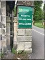
Entrance to Rosetta Holiday Park
Entrance to Rosetta Holiday Park, OS Cut Mark on the left hand side of the entrance pillar
Image: © thejackrustles
Taken: 29 May 2017
0.10 miles
10

Path by the Eddleston Water, Peebles
A path behind Dalatho Crescent on the northern side of the town.
Image: © Jim Barton
Taken: 11 May 2021
0.10 miles