
IMAGES TAKEN NEAR TO
Traquair Road, INNERLEITHEN, EH44 6RN
Introduction
This page details the photographs taken nearby to Traquair Road, EH44 6RN by members of the Geograph project.
The Geograph project started in 2005 with the aim of publishing, organising and preserving representative images for every square kilometre of Great Britain, Ireland and the Isle of Man.

There are currently over 7.5m images from over14,400 individuals and you can help contribute to the project by visiting https://www.geograph.org.uk
Image Map
Images are licensed for reuse under creativecommons.org/licenses/by-sa/2.0
Notes
- Clicking on the map will re-center to the selected point.
- The higher the marker number, the further away the image location is from the centre of the postcode.
Image Listing (196 Images Found)
Images are licensed for reuse under creativecommons.org/licenses/by-sa/2.0
Image
Details
Distance
1

Building site, Innerleithen
New apartments under construction in Traquair Road; Sunday morning, but the crane was working.
Image: © Jim Barton
Taken: 20 Jan 2013
0.01 miles
2

New Housing at Clough Mills
A Miller Homes scheme at Traquair Road in Innerleithen on the former Clough Mill site. With the credit crunch in full swing, these homes may take a while to sell. For a view of the cleared site from the same viewpoint almost a year ago, see Image
Image: © Walter Baxter
Taken: 26 Sep 2008
0.02 miles
3

Innerleithen station master's house
Innerleithen railway station lay on the Peebles to Galashiels line, closed in February 1962. This was the house provided for the station master. The railway crossed the road on the level by the trees on the right and the end of the canopy over the surviving platform can be seen behind the car.
Image: © A-M-Jervis
Taken: 22 Oct 2005
0.02 miles
4

Building site at Innerleithen
This cleared site at Clough Mill, Traquair Road, is to be redeveloped to form dwelling houses, townhouses and flats, with associated roads and parking.
Image: © Walter Baxter
Taken: 24 Oct 2007
0.02 miles
5

New housing development in Innerleithen
The houses are due to be completed in May providing for more people in the little Peeblesshire town.
Image: © James Denham
Taken: 17 Mar 2013
0.02 miles
6

Ordnance Survey Cut Mark
This can be found on the wall of a house - private dwelling - in Traquair Road, Innerleithen.
For more detail see : http://www.bench-marks.org.uk/bm72399
Image: © Peter Wood
Taken: 14 Oct 2015
0.03 miles
7

Traquair Road (N709) in Innerleithen
Looking south-eastward towards Tweed Bridge.
Image: © Peter Wood
Taken: 14 Oct 2015
0.03 miles
8
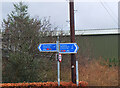
Cycle Network signpost, Innerleithen
From the Tweed Valley Railway Path for routes north to Edinburgh via the B709 or east to Galashiels by the minor road on the south bank of the Tweed.
Image: © Jim Barton
Taken: 23 Feb 2022
0.03 miles
9

A Miller Homes scheme in Innerleithen
New houses on the former Clough Mill site at Traquair Road, that may take a while to sell due to the credit crunch. For a similar view of the cleared site almost a year ago, see Image
Image: © Walter Baxter
Taken: 26 Sep 2008
0.04 miles
10

Railway path, Innerleithen
The start of the Tweed Valley Railway Path - a 'multi-use path' in the planners' jargon - on the old Peebles railway route. From here there is now a continuous off-road path to Peebles via a footbridge, opened in 2013, over the Tweed at Cardrona.
Image: © Jim Barton
Taken: 15 Feb 2016
0.04 miles