
IMAGES TAKEN NEAR TO
Orchard Road South, EDINBURGH, EH4 3EN
Introduction
This page details the photographs taken nearby to Orchard Road South, EH4 3EN by members of the Geograph project.
The Geograph project started in 2005 with the aim of publishing, organising and preserving representative images for every square kilometre of Great Britain, Ireland and the Isle of Man.

There are currently over 7.5m images from over14,400 individuals and you can help contribute to the project by visiting https://www.geograph.org.uk
Image Map
Images are licensed for reuse under creativecommons.org/licenses/by-sa/2.0
Notes
- Clicking on the map will re-center to the selected point.
- The higher the marker number, the further away the image location is from the centre of the postcode.
Image Listing (40 Images Found)
Images are licensed for reuse under creativecommons.org/licenses/by-sa/2.0
Image
Details
Distance
1

Edinburgh Sunrise
A golden winter sky silhouettes the Castle and Arthur's Seat.
Image: © Anne Burgess
Taken: 17 Nov 2016
0.06 miles
2

Orchard Road
Looking north and downhill from the traffic island at the intersection of Orchard Road with Ravelston Dykes.
Image: © Anne Burgess
Taken: 2 Mar 2012
0.07 miles
3
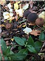
Cucumber Caps
Dark brown toadstools [Macrocystidia cucumis] in a friend's garden. An occasional but widespread fungus of rich soils in woodland and gardens. It smells slightly of cucumber, hence the name. The cap is minutely felty, so has a matt appearance. The caps are up to 4-5 cm diam.; these were a little smaller.
Image: © Barbara Richardson
Taken: 28 Oct 2022
0.08 miles
4

Orchard Road South
A residential road that has become another of Edinburgh's suburban car parks.
Image: © M J Richardson
Taken: 27 Mar 2008
0.08 miles
5

Ravelston Dykes
Road running along a shallow eastern ridge of Corstorphine Hill.
Image: © Callum Black
Taken: 3 Jun 2006
0.08 miles
6
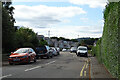
Blinkbonny Gardens
A suburban street handy for Queensferry Road and access to the city centre. Corstorphine Hill is on the skyline.
Image: © Anne Burgess
Taken: 16 Sep 2021
0.09 miles
7
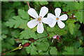
Herb Robert (Geranium robertianum)
Normally this plant has bright pink flowers, but along the edge of the pavement here they are white.
Image: © Anne Burgess
Taken: 16 Sep 2021
0.10 miles
8

Cycleway below Ravelston Dyke
Former railway line running north-west from Haymarket.
Image: © Christine Johnstone
Taken: 18 Jan 2011
0.12 miles
9

Bridge over former railway, now Roseburn Path
Ravelston Dykes crosses the route of the Caledonian line to Granton and Leith.
Image: © Robin Webster
Taken: 20 Oct 2019
0.12 miles
10

Cycle Route
The former railway line has been surfaced and forms part of the city's cycle and footpath network. This is the view looking north from the overbridge which carries Ravelston Dykes.
Image: © Anne Burgess
Taken: 2 Mar 2012
0.12 miles