
IMAGES TAKEN NEAR TO
Ferry Road, EDINBURGH, EH4 2TU
Introduction
This page details the photographs taken nearby to Ferry Road, EH4 2TU by members of the Geograph project.
The Geograph project started in 2005 with the aim of publishing, organising and preserving representative images for every square kilometre of Great Britain, Ireland and the Isle of Man.

There are currently over 7.5m images from over14,400 individuals and you can help contribute to the project by visiting https://www.geograph.org.uk
Image Map
Images are licensed for reuse under creativecommons.org/licenses/by-sa/2.0
Notes
- Clicking on the map will re-center to the selected point.
- The higher the marker number, the further away the image location is from the centre of the postcode.
Image Listing (59 Images Found)
Images are licensed for reuse under creativecommons.org/licenses/by-sa/2.0
Image
Details
Distance
1

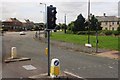
The Red Bridge and Ferry Road, Granton
The footbridge replaced a railway bridge as this was the former Caledonian Railway looking towards Crewe Junction, about 200m away.
Image: © Nigel Thompson
Taken: 1 Jun 2024
0.02 miles
3
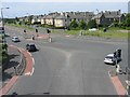
Ferry Road junction with West Granton access road
Taken from the cycle path footbridge.
Image: © Robert Struthers
Taken: 25 Jun 2009
0.04 miles
4

Footbridge over Ferry Road, Edinburgh
On the cycleway to Newhaven and Leith, a former railway line.
Image: © Jim Barton
Taken: 23 Jun 2016
0.04 miles
5
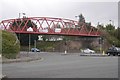
Bridge over Ferry Road
It replaces a long lost railway bridge as part of a cycle path network. Often festooned with bedsheet litter.
Image: © Richard Webb
Taken: 4 Oct 2019
0.04 miles
6
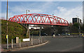
The Red Bridge
For obvious reasons this bridge is known to local residents as the Red Bridge. It spans a gap where the original railway bridge was demolished, and it was built to carry the Telford Path cycle route across Ferry Road.
Image: © Anne Burgess
Taken: 29 Mar 2012
0.04 miles
7
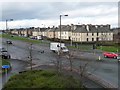
Homes on the north side of Ferry Road
Flats, I think. Seen from the south side of the red cycleway bridge.
Image: © Christine Johnstone
Taken: 5 Feb 2014
0.05 miles
8

Northern-most towers, west of Telford Grove
The nearest is a radar antenna test tower, now disused apparently. Part of the Selex factory complex.
Image: © Christine Johnstone
Taken: 5 Feb 2014
0.05 miles
9
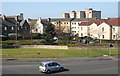
Looking towards Ferry Road Avenue
Ferry Road Avenue is one of the streets in this estate of council flats north of Ferry Road. It is beyond the apex of the grass triangle seen here from the bridge which carries the cycle route over Ferry Road.
Image: © Anne Burgess
Taken: 27 Mar 2012
0.05 miles
10

Ferry Road bridge
Pedestrian/cyclist bridge crossing Ferry Road and linking the Telford Path with the Ferry Road Path.
Image: © Callum Black
Taken: 14 Mar 2009
0.06 miles