
IMAGES TAKEN NEAR TO
Wester Drylaw Avenue, EDINBURGH, EH4 2SH
Introduction
This page details the photographs taken nearby to Wester Drylaw Avenue, EH4 2SH by members of the Geograph project.
The Geograph project started in 2005 with the aim of publishing, organising and preserving representative images for every square kilometre of Great Britain, Ireland and the Isle of Man.

There are currently over 7.5m images from over14,400 individuals and you can help contribute to the project by visiting https://www.geograph.org.uk
Image Map
Images are licensed for reuse under creativecommons.org/licenses/by-sa/2.0
Notes
- Clicking on the map will re-center to the selected point.
- The higher the marker number, the further away the image location is from the centre of the postcode.
Image Listing (32 Images Found)
Images are licensed for reuse under creativecommons.org/licenses/by-sa/2.0
Image
Details
Distance
1

Edinburgh Architecture : Drylaw Parish Church - Tower And Nave
Image: © Richard West
Taken: 15 Jan 2015
0.08 miles
2

Edinburgh Architecture : Drylaw Parish Church - View From SSW
Image: © Richard West
Taken: 15 Jan 2015
0.09 miles
3
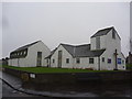
Edinburgh Townscape : Drylaw Parish Church
Built 1956/7 as part of the Church Of Scotland Extension Scheme.
Architect - (Sir) William Hardie Kininmonth (1904 - 1988) of the architectural practice Rowand Anderson Kininmonth & Paul.
Basic cost of construction £19,021 (£3 4s. 7d. per square foot).
Image: © Richard West
Taken: 15 Jan 2015
0.10 miles
4
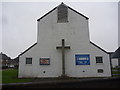
Edinburgh Architecture : Drylaw Parish Church - West Facade
Built 1956/7 as part of the Church Of Scotland Extension Scheme.
Architect - (Sir) William Hardie Kininmonth (1904 - 1988) of the architectural practice Rowand Anderson Kininmonth & Paul.
Basic cost of construction £19,021 (£3 4s. 7d. per square foot).
Image: © Richard West
Taken: 15 Jan 2015
0.10 miles
5
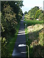
View of the Silverknowes cycle path from Telford road.
Image: © Alan Stewart
Taken: 20 Sep 2010
0.17 miles
6
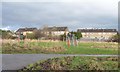
Small basketball court by the cycleway
These have been installed across Edinburgh. The houses to the north are in Wester Drylaw Drive.
Image: © Christine Johnstone
Taken: 5 Feb 2014
0.17 miles
7

Play area and housing, Blackhall Edinburgh
Basketball hoops on green space in the suburbs on the west side of the city, seen from the Blackhall Path.
Image: © Jim Barton
Taken: 22 Sep 2016
0.17 miles
8

Pathside undergrowth
Scrubby trees and undergrowth, typical urban pathside greenery. This is by the Blackhall Path, part of Edinburgh's extensive network of pedestrian and cycle routes using the paths of old railways. The Blackhall Path just sneaks into a corner of this square.
The wildlife potential of such paths sometimes sees them referred to as Linear Parks.
Image: © Callum Black
Taken: 14 Mar 2009
0.18 miles
9

Cycle path, Drylaw
Trackbed of the branch line to Barnton. A remnant of route 1 of the National Cycle Network.
Image: © Richard Webb
Taken: 31 Jan 2022
0.18 miles
10

Blackhall Path under grey skies
Running alongside the back gardens of houses in Wester Drylaw Drive.
Image: © Christine Johnstone
Taken: 5 Feb 2014
0.19 miles