
IMAGES TAKEN NEAR TO
Easter Drylaw Avenue, EDINBURGH, EH4 2RA
Introduction
This page details the photographs taken nearby to Easter Drylaw Avenue, EH4 2RA by members of the Geograph project.
The Geograph project started in 2005 with the aim of publishing, organising and preserving representative images for every square kilometre of Great Britain, Ireland and the Isle of Man.

There are currently over 7.5m images from over14,400 individuals and you can help contribute to the project by visiting https://www.geograph.org.uk
Image Map
Images are licensed for reuse under creativecommons.org/licenses/by-sa/2.0
Notes
- Clicking on the map will re-center to the selected point.
- The higher the marker number, the further away the image location is from the centre of the postcode.
Image Listing (27 Images Found)
Images are licensed for reuse under creativecommons.org/licenses/by-sa/2.0
Image
Details
Distance
1
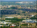
Fettes College and Edinburgh Castle from the air
The exceedingly grand 1869 college buildings are towards the lower left corner of the photo, the castle is on the rock outcrop in the centre. Viewed from an aircraft on final approach to Edinburgh Airport.
Image: © Thomas Nugent
Taken: 20 May 2011
0.12 miles
2

Edinburgh Roofscape
In fact many of these snow-covered roofs are in Leith rather than Edinburgh, all foreshortened in a telephoto view from Corstorphine Hill.
Image: © Anne Burgess
Taken: 3 Jan 2010
0.12 miles
3

Children's Playground
This well-equipped play area, just off Telford Path, is being well used by the local children. The houses are on Easter Drylaw Drive.
Image: © Anne Burgess
Taken: 12 May 2012
0.14 miles
4

Edinburgh Architecture : Drylaw Parish Church - View From SSW
Image: © Richard West
Taken: 15 Jan 2015
0.15 miles
5

Recreation ground, south of Easter Drylaw Drive
Alongside the former Slateford - Granton railway, now a footpath and cycleway.
Image: © Christine Johnstone
Taken: 5 Feb 2014
0.15 miles
6

Walking the dog on the former railway line
Opened in 1861 as the Slateford - Granton line. Now a cycleway and footpath.
Image: © Christine Johnstone
Taken: 5 Feb 2014
0.16 miles

8

Edinburgh Architecture : Drylaw Parish Church - Tower And Nave
Image: © Richard West
Taken: 15 Jan 2015
0.16 miles

10
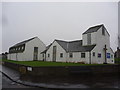
Edinburgh Townscape : Drylaw Parish Church
Built 1956/7 as part of the Church Of Scotland Extension Scheme.
Architect - (Sir) William Hardie Kininmonth (1904 - 1988) of the architectural practice Rowand Anderson Kininmonth & Paul.
Basic cost of construction £19,021 (£3 4s. 7d. per square foot).
Image: © Richard West
Taken: 15 Jan 2015
0.17 miles