
IMAGES TAKEN NEAR TO
Orchard Drive, EDINBURGH, EH4 2DY
Introduction
This page details the photographs taken nearby to Orchard Drive, EH4 2DY by members of the Geograph project.
The Geograph project started in 2005 with the aim of publishing, organising and preserving representative images for every square kilometre of Great Britain, Ireland and the Isle of Man.

There are currently over 7.5m images from over14,400 individuals and you can help contribute to the project by visiting https://www.geograph.org.uk
Image Map
Images are licensed for reuse under creativecommons.org/licenses/by-sa/2.0
Notes
- Clicking on the map will re-center to the selected point.
- The higher the marker number, the further away the image location is from the centre of the postcode.
Image Listing (40 Images Found)
Images are licensed for reuse under creativecommons.org/licenses/by-sa/2.0
Image
Details
Distance
1
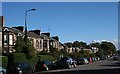
Craigleith Road
A useful link between western Edinburgh and Stockbridge, Craigleith Road is lined with Victorian villas built of the pale sandstone from Craigleith Quarry at the west end of the street. I was intrigued to see Image
Image: © Anne Burgess
Taken: 4 Oct 2010
0.07 miles
2
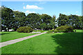
Orchard Park North
The path leads across the park from Queensferry Road to Orchard Road.
Image: © Anne Burgess
Taken: 16 Sep 2021
0.08 miles
3
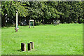
Orchard Park North
Assorted play equipment round the north-east perimeter of the park.
Image: © Anne Burgess
Taken: 16 Sep 2021
0.08 miles
4
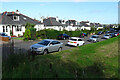
Orchard Road
Inter-war bungalows, many with inserted dormers lighting loft conversions, line the north side of Orchard Road. On the south side of the road is Orchard Park North.
Image: © Anne Burgess
Taken: 16 Sep 2021
0.10 miles
5
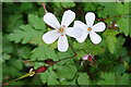
Herb Robert (Geranium robertianum)
Normally this plant has bright pink flowers, but along the edge of the pavement here they are white.
Image: © Anne Burgess
Taken: 16 Sep 2021
0.12 miles
6
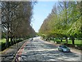
The road to Queensferry 3
The A90 at Orchard Park which follows the line of a raised beach from the last Glacial Age.
Image
Image: © kim traynor
Taken: 23 May 2012
0.13 miles
7

Ivy-covered Street Light
I know that ivy is a tenacious climber, but I was surprised to see that it has managed to climb almost to the top of this street light. I rather like it, but it will be interesting to see how long it is allowed to remain there before the council has it removed.
Image: © Anne Burgess
Taken: 4 Oct 2010
0.14 miles
8

Corn Marigold
There were lots of these in amongst a narrow wildflower strip running along the Northern edge of Orchard Park South. The plant's Latin name is 'Glebionis segetum'. Until 25 years ago, however, it went by the name 'Chrysanthemum segetum' which can cause some confusion as several websites (and obviously lots of old books) still use the old name. The petals look like something has nibbled a bit out of the end of them.
According to the Wikipedia page on the flower - bits of which are copied and pasted shamelessly by numerous other sites - they are particularly good sources of pollen and nectar, have a long blooming period, and attract bees, hoverflies and small butterflies in large numbers. So with the current drive to increase pollinator numbers in the UK they are an increasingly common sight.
They are thought to originate from the Eastern Mediterranean but have been in this country for hundreds, or perhaps thousands, of years. Wikipedia's nice little bit of trivia is that there was supposedly a 13th Century royal decree in Scotland stating that if anyone let the flowers grow on their land they would forfeit a sheep to the king.
Image: © Ian Dodds
Taken: 19 Jul 2024
0.14 miles
9
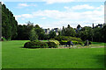
Orchard Park South
Queensferry Road lies between the two parts of Orchard Park. The houses are in Blinkbonny Gardens.
Image: © Anne Burgess
Taken: 16 Sep 2021
0.14 miles
10
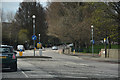
Edinburgh : Queensferry Road A90
Looking along Queensferry Road as it heads through Edinburgh.
Image: © Lewis Clarke
Taken: 22 Apr 2016
0.15 miles