
IMAGES TAKEN NEAR TO
House O'Hill Road, EDINBURGH, EH4 2AN
Introduction
This page details the photographs taken nearby to House O'Hill Road, EH4 2AN by members of the Geograph project.
The Geograph project started in 2005 with the aim of publishing, organising and preserving representative images for every square kilometre of Great Britain, Ireland and the Isle of Man.

There are currently over 7.5m images from over14,400 individuals and you can help contribute to the project by visiting https://www.geograph.org.uk
Image Map
Images are licensed for reuse under creativecommons.org/licenses/by-sa/2.0
Notes
- Clicking on the map will re-center to the selected point.
- The higher the marker number, the further away the image location is from the centre of the postcode.
Image Listing (54 Images Found)
Images are licensed for reuse under creativecommons.org/licenses/by-sa/2.0
Image
Details
Distance
1

Barnton Branch
The trackbed of the Caledonian Railway's line to Cramond Brig is now a shared use path and part of the National Cycle Network (Route 1).
Image: © Richard Webb
Taken: 27 Mar 2021
0.04 miles
2
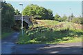
Blackhall Path near Silverknowes, Edinburgh
An exit ramp from the cyclepath to Wester Drylaw. The path continues almost 1km to Davidson's Mains.
Image: © Jim Barton
Taken: 22 Sep 2016
0.07 miles
3

Bridge over Blackhall Path
Dating from its days as the railway line to Barnton.
Image: © Christine Johnstone
Taken: 5 Feb 2014
0.09 miles
4

Blackhall Path near Drylaw, Edinburgh
The cyclepath on the former branch line to Barnton. Several former railway routes have been converted into a useful network of cyclepaths in this area of Edinburgh.
Image: © Jim Barton
Taken: 22 Sep 2016
0.09 miles
5
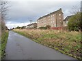
Flats / tenements, Wester Drylaw Drive
Seen from Blackhall Path.
Image: © Christine Johnstone
Taken: 5 Feb 2014
0.10 miles
6

Path, Drylaw
The path on an embankment was once a road crossing the Barnton Branch Railway and serving House of Hill, a vanished farm.
Image: © Richard Webb
Taken: 31 Jan 2022
0.12 miles
7

Link path to Sustrans Cycle Route 1, Silverknowes
A narrow path (towards right of shot) leaves the B9085, Ferry Road, to join the Blackhall Path, part of the national route.
Image: © michael ely
Taken: 22 Feb 2011
0.12 miles
8

Drylaw seen from the former Barnton Railway
Image: © Richard Webb
Taken: 31 Jan 2022
0.13 miles
9

Houses in Corbiehill Avenue
Corbiehill Avenue is a typical suburban Edinburgh residential road consisting mainly of bungalows. It runs from Corbiehill Rd to House of Hill Rd.
Image: © Nigel Mykura
Taken: 10 Sep 2015
0.13 miles
10

Granton : Wester Drylaw Drive
Looking off Ferry Road.
Image: © Lewis Clarke
Taken: 23 Sep 2020
0.14 miles