
IMAGES TAKEN NEAR TO
South Learmonth Gardens, EDINBURGH, EH4 1EZ
Introduction
This page details the photographs taken nearby to South Learmonth Gardens, EH4 1EZ by members of the Geograph project.
The Geograph project started in 2005 with the aim of publishing, organising and preserving representative images for every square kilometre of Great Britain, Ireland and the Isle of Man.

There are currently over 7.5m images from over14,400 individuals and you can help contribute to the project by visiting https://www.geograph.org.uk
Image Map
Images are licensed for reuse under creativecommons.org/licenses/by-sa/2.0
Notes
- Clicking on the map will re-center to the selected point.
- The higher the marker number, the further away the image location is from the centre of the postcode.
Image Listing (208 Images Found)
Images are licensed for reuse under creativecommons.org/licenses/by-sa/2.0
Image
Details
Distance
1

Learmonth View
Above Comely Bank with trees in Inverleith Park in the distance. All the Learmonth names are due to John Learmonth who owned the land here when the Dean Bridge was built and the site developed.
Image: © Richard Webb
Taken: 28 Oct 2024
0.05 miles
2
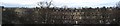
Panorama of Learmonth Terrace
Western end of Learmonth Terrace from 3rd floor of 31 Buckingham Terrace.
The very top of the spire of Fettes school can just been seen in the centre of the picture.
Image: © Alan Slater
Taken: 6 Jan 2013
0.05 miles
3
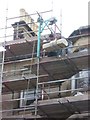
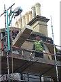
Tenement repair, Belgrave Place
Raising this stone into position turned out to be a lot harder than it looked. Now that the old quarries that supplied the Edinburgh building trade have gone, Hailes, Craigleith or Binnie stone is no longer available and a match has to be found from further afield in Aberdeenshire or Orkney.
Image: © kim traynor
Taken: 12 Oct 2010
0.07 miles
5
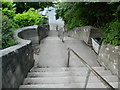
Steps from South Learmonth Ave to Learmonth Ave, Edinburgh
Image: © John Lord
Taken: 24 Jun 2013
0.08 miles
6

Comely Bank Avenue
The view down Comely Bank Avenue from Dean Park Crescent. The tenements on the right hand side of the street are good examples of the type of property in this area. In the road in the distance (the continuation of Comely Bank Avenue) is East Fettes Avenue.
Image: © Sandy Gemmill
Taken: 5 Feb 2007
0.08 miles
8

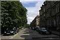
Learmonth Terrace
Viewed across the A90 Queensferry Road from Buckingham Terrace. Category B Listed http://portal.historicenvironment.scot/designation/LB29246 .
Image: © Thomas Nugent
Taken: 27 Aug 2018
0.09 miles
9

Buckingham Terrace
The north end of the Category B Listed terrace http://portal.historicenvironment.scot/designation/LB28405 which runs parallel to the A90 Queensferry Road.
Image: © Thomas Nugent
Taken: 27 Aug 2018
0.09 miles
10

Buckingham Terrace
The north end of the Category B Listed terrace http://portal.historicenvironment.scot/designation/LB28405 which runs parallel to the A90 Queensferry Road.
Image: © Thomas Nugent
Taken: 27 Aug 2018
0.09 miles