
IMAGES TAKEN NEAR TO
Queens Avenue, HADDINGTON, EH41 3BW
Introduction
This page details the photographs taken nearby to Queens Avenue, EH41 3BW by members of the Geograph project.
The Geograph project started in 2005 with the aim of publishing, organising and preserving representative images for every square kilometre of Great Britain, Ireland and the Isle of Man.

There are currently over 7.5m images from over14,400 individuals and you can help contribute to the project by visiting https://www.geograph.org.uk
Image Map
Images are licensed for reuse under creativecommons.org/licenses/by-sa/2.0
Notes
- Clicking on the map will re-center to the selected point.
- The higher the marker number, the further away the image location is from the centre of the postcode.
Image Listing (7 Images Found)
Images are licensed for reuse under creativecommons.org/licenses/by-sa/2.0
Image
Details
Distance
1

Queen's Avenue, Haddington
Seen from the old bypass.
Image: © Richard Webb
Taken: 30 Nov 2010
0.11 miles
2

Potato field in Haddington.
This field is just off Aberlady Road, between the old and new by-passes. As it is inside the new bypass, it will almost certainly be built upon very soon.
Image: © Richard Webb
Taken: 10 Jun 2005
0.15 miles
3

Haddington : A1
Looking along the A1 through the East Lothian region.
Image: © Lewis Clarke
Taken: 23 Sep 2020
0.16 miles
4
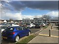
East Lothian Community Hospital
On the Roodlands site. On my way to the first dose of the Astra Zeneca Covid 19 vaccine.
Image: © Richard Webb
Taken: 26 Mar 2021
0.18 miles
5
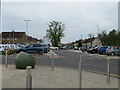
Davidson Terrace, Haddington
A view east from the new East Lothian Community Hospital car park.
Image: © M J Richardson
Taken: 5 May 2023
0.21 miles
6
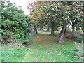
Path, Haddington
Wooded path behind Davidson Terrace. Looks a bit like a disused railway, but was not a railway.
Image: © Richard Webb
Taken: 12 Oct 2010
0.22 miles
7

O2 Mobile Phone Mast, N of Haddington
O2 mobile phone mast, N of Haddington, right next to the A6137.
Image: © Calum Young
Taken: 13 Feb 2010
0.23 miles