
IMAGES TAKEN NEAR TO
Freer Street, EH3 9FQ
Introduction
This page details the photographs taken nearby to Freer Street, EH3 9FQ by members of the Geograph project.
The Geograph project started in 2005 with the aim of publishing, organising and preserving representative images for every square kilometre of Great Britain, Ireland and the Isle of Man.

There are currently over 7.5m images from over14,400 individuals and you can help contribute to the project by visiting https://www.geograph.org.uk
Image Map
Images are licensed for reuse under creativecommons.org/licenses/by-sa/2.0
Notes
- Clicking on the map will re-center to the selected point.
- The higher the marker number, the further away the image location is from the centre of the postcode.
Image Listing (810 Images Found)
Images are licensed for reuse under creativecommons.org/licenses/by-sa/2.0
Image
Details
Distance
1
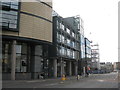
Fountainbridge, Edinburgh
Part of the Edinburgh Quay development, with another office block going up just at the end.
Image: © M J Richardson
Taken: 17 Sep 2019
0.01 miles
2
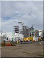
New office block under construction at Fountainbridge
And contractors buildings. This is a western extension of the existing Edinburgh Quay development. For 5 years earlier see Image
Image: © M J Richardson
Taken: 17 Sep 2019
0.01 miles
3

Lochrin Basin
Redevelopment of the Lochrin basin of the Union Canal at Fountainbridge, Edinburgh. The canal was built to link Edinburgh with the Forth and Clyde Canal at the Bowling Basin in Falkirk. It was completed in 1822 and opened the following year, having cost £461,760. Among other goods such as sugar, tea and coffee, it conveyed mainly coal, quarried limestone and passengers (before the advent of the railways some 20 years later). The canal closed officially in 1962. The renewal of the basin has been part of an extensive clean-up of the canal which now meets the Forth and Clyde above the Falkirk Wheel. It takes at least 12 hours to travel its length of 31.5 miles (50.5 km).
"For Coal, Coke and Charcoal, there is payable for the Edinburgh stage at the rate of five-eighths of a penny per ton per mile, and for the Broxburn and Linlithgow stages at the rate of one penny per ton per mile, and for the Redding stage no toll is at present charged.
For Gunpowder, there is payable at the rate of fourpence per ton per mile for each of the four stages.
For Passengers, there is payable a halfpenny per mile for each of the four stages of the Canal."
(Edinburgh & Glasgow Railway Company* announcement, 1849)
*the railway had bought out the canal company
For an explanation of the stages, see Image
Image: © kim traynor
Taken: 3 Apr 2007
0.01 miles
4

Fountainbridge
Looking towards the site of the former Scottish & Newcastle bottling plant from Gardner's Crescent.
Image: © Thomas Nugent
Taken: 12 Aug 2012
0.02 miles
5

Fountainbridge
Looking towards the site of the former Fountain Brewery from Gardner's Crescent.
Image: © Thomas Nugent
Taken: 12 Aug 2012
0.02 miles
6

Edinburgh Quay 2
One of the new office blocks springing up around the canal basin in the city centre. It does not suffer from juxtaposition with traditional buildings, is quite impressive, and has a superb view from the fourth floor - though unfortunately Companies House isn't able to access the roof to enjoy it. The adjacent waste ground to its right was occupied by Fountainbridge Brewery.
Image: © Anne Burgess
Taken: 27 Sep 2011
0.02 miles

8
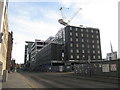
Development at Fountainbridge
A new hotel and offices etc. going up on the site of the old brewery at Gilmore Park.
Image: © M J Richardson
Taken: 9 Nov 2019
0.03 miles
9
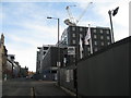
Building site, Fountainbridge
A new hotel and offices etc. going up on the site of the old brewery at Gilmore Park. Looking east to the existing redeveloped area.
Image: © M J Richardson
Taken: 9 Nov 2019
0.03 miles
10

Fountainbridge and part of Edinburgh Quay
The Scottish & Newcastle brewery site cleared for redevelopment, and part of the commercial redevelopment of the area.
Image: © M J Richardson
Taken: 18 Dec 2012
0.03 miles