
IMAGES TAKEN NEAR TO
East Fountainbridge, EDINBURGH, EH3 9BH
Introduction
This page details the photographs taken nearby to East Fountainbridge, EH3 9BH by members of the Geograph project.
The Geograph project started in 2005 with the aim of publishing, organising and preserving representative images for every square kilometre of Great Britain, Ireland and the Isle of Man.

There are currently over 7.5m images from over14,400 individuals and you can help contribute to the project by visiting https://www.geograph.org.uk
Image Map
Images are licensed for reuse under creativecommons.org/licenses/by-sa/2.0
Notes
- Clicking on the map will re-center to the selected point.
- The higher the marker number, the further away the image location is from the centre of the postcode.
Image Listing (871 Images Found)
Images are licensed for reuse under creativecommons.org/licenses/by-sa/2.0
Image
Details
Distance
1

Behind Lauriston Place
The other side of the buildings along Lauriston Place. There are arches out to High Riggs and Lauriston Place.
Image: © Richard Webb
Taken: 30 Jan 2016
0.00 miles


4

Bread Street Lane
Pends like the one above can be found all over central Edinburgh and are a reminder of the days of horse-drawn transport. Even this small alleyway cannot escape traffic signage and the ubiquitous yellow lines of modern parking restrictions.
Image: © kim traynor
Taken: 25 May 2009
0.03 miles
5

Thrift Is Blessing continued
One year after commenting on the missing 'U' above the doorway, it has suddenly reappeared after a long absence, albeit in a slimmer version. The words come from the mouth of Shylock in Shakespeare's 'The Merchant of Venice' when he defends moneylending - "And thrift is blessing, if men steal it is not."
Image
Image: © kim traynor
Taken: 2 Jul 2010
0.03 miles
6

Arch through to Lauriston Place
The Ordnance Survey don't show the through routes under buildings, but they do show up on orienteering maps. Have a look at http://www.euoc.routegadget.co.uk/rg2/ which has a selection of fine maps of the streets of Edinburgh.
Image: © Richard Webb
Taken: 30 Jan 2016
0.03 miles
7

Lost housing
An infestation of key boxes reveals that this square is now plagued by short term lets and several dwellings have been displaced.
Image: © Richard Webb
Taken: 1 Sep 2019
0.03 miles
8

Bank entrance, Lothian Road
Mosaic on what was once a branch of the Trustee Savings Bank, and probably a local savings bank before that.
Image: © Richard Webb
Taken: 4 Jul 2010
0.03 miles
9
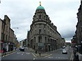
St Cuthbert's Building from Main Point
Department store building that was once the main retail outlet of the St Cuthbert's Co-operative Association on the corner of East Fountainbridge and Bread Street. It closed in the 1980s and is now leased to a range of businesses. The junction here is known as Main Point where the road from the city split in three directions: to the north (Stirling) on the right; to the west (Glasgow) on the left; and to the south-west (Carlisle) via High Riggs, another street just off-frame to the left.
Image: © kim traynor
Taken: 27 May 2009
0.03 miles
10
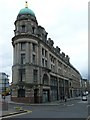
St Cuthbert's Building, Bread Street
Formerly the main Department Store of the St Cuthbert's Cooperative Association, this building occupies most of the south side of Bread Street.
Image: © kim traynor
Taken: 27 May 2009
0.03 miles