
IMAGES TAKEN NEAR TO
McEwan Square, EDINBURGH, EH3 8EN
Introduction
This page details the photographs taken nearby to McEwan Square, EH3 8EN by members of the Geograph project.
The Geograph project started in 2005 with the aim of publishing, organising and preserving representative images for every square kilometre of Great Britain, Ireland and the Isle of Man.

There are currently over 7.5m images from over14,400 individuals and you can help contribute to the project by visiting https://www.geograph.org.uk
Image Map
Images are licensed for reuse under creativecommons.org/licenses/by-sa/2.0
Notes
- Clicking on the map will re-center to the selected point.
- The higher the marker number, the further away the image location is from the centre of the postcode.
Image Listing (926 Images Found)
Images are licensed for reuse under creativecommons.org/licenses/by-sa/2.0
Image
Details
Distance
1
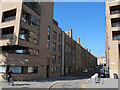
McEwan Square
An existing street (Upper Grove Place) has been extended at the west end to merge with a new development, Melvin Walk.
Image: © Stephen Craven
Taken: 7 Jun 2013
0.01 miles
2

Old and New Fountainbridge
Where the new Fountainbridge meets the old: McEwan Square from the 21st century joins Upper Grove Place from the 19th century.
Image: © kim traynor
Taken: 16 Aug 2011
0.01 miles
3

Melvin Walk ? transport (2)
City transport modes are catered for in this new development Image with cycle racks adjacent to a City Car Club parking bay.
Image: © Stephen Craven
Taken: 7 Jun 2013
0.02 miles
4

Tenements in Upper Grove Place
Tenements with rusticated stonework from 1865.
Image: © kim traynor
Taken: 25 May 2009
0.03 miles
5

North end of Melvin Walk
Traffic on the West Approach Road stopped at a pedestrian crossing, beyond which is a new traffic-free urban street with an avenue of trees planted either side.
Image: © Stephen Craven
Taken: 7 Jun 2013
0.03 miles
6

Victorian tenement, Upper Grove Place
Housing for the industrial working class, erected in 1863. The English Football Association had just been formed, the Prussian prime minister, Otto von Bismarck, was wrestling with the Schleswig-Holstein question and the American Civil War had run half its course, reaching a turning-point with the Battle of Gettysburg. Of course, none of this was beamed in by satellite.
Image: © kim traynor
Taken: 16 Aug 2011
0.04 miles
7

Residential housing, Fountainbridge
When will they ever learn? The major urban renewal of the Fountainbridge district has given Edinburgh Council a once-in-a-century opportunity to transform one of the ugliest parts of Edinburgh into a landscape fit for living in the 21st century. This is part of their unimaginative solution.
Image: © kim traynor
Taken: 25 Jun 2010
0.04 miles
8
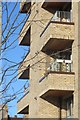
Melvin Walk, Fountainbridge
Redevelopment of the brewery site.
Image: © Richard Webb
Taken: 30 Jan 2015
0.05 miles
9

Melvin Walk
A shared-use space (pedestrian/cyclist) with a new development Image to the west, and hoardings to the east where I expect another development will arise.
Image: © Stephen Craven
Taken: 7 Jun 2013
0.05 miles
10

Melvin Walk
A connecting link between Fountainbridge and Morrison Circus, and on to Haymarket. Part of the redevelopment of this once industrial area.
Image: © M J Richardson
Taken: 3 Apr 2014
0.05 miles