
IMAGES TAKEN NEAR TO
Glenogle Road, EDINBURGH, EH3 5JB
Introduction
This page details the photographs taken nearby to Glenogle Road, EH3 5JB by members of the Geograph project.
The Geograph project started in 2005 with the aim of publishing, organising and preserving representative images for every square kilometre of Great Britain, Ireland and the Isle of Man.

There are currently over 7.5m images from over14,400 individuals and you can help contribute to the project by visiting https://www.geograph.org.uk
Image Map
Images are licensed for reuse under creativecommons.org/licenses/by-sa/2.0
Notes
- Clicking on the map will re-center to the selected point.
- The higher the marker number, the further away the image location is from the centre of the postcode.
Image Listing (412 Images Found)
Images are licensed for reuse under creativecommons.org/licenses/by-sa/2.0
Image
Details
Distance
1

Inside Glenogle Baths, Stockbridge
Now styled the Glenogle Swim Centre, the pool re-opened in 2010 after a campaign to save it encouraged a mult-million pound make-over by Edinburgh Leisure. The 'Glennies' were Victorian municipal baths built to serve the Stockbridge area, including the 'Colonies', built opposite in the 1860s without baths.
Image: © kim traynor
Taken: 5 Jan 2011
0.01 miles
2

Former 'Colony Shop', Glenogle Road
One of the former shops that served the population of the Stockbridge 'colonies' - workers' dwellings built by the Edinburgh Co-operative Building Company, established in 1861. It was known as 'Harvey's', 'Elmslie's', 'Linton's' and 'Kelly's', after its various owners. The original roof has been altered.
Image: © kim traynor
Taken: 5 Jan 2011
0.02 miles
3

Walkway to Glenogle Road
This zig-zagging path provides pedestrian access between Saxe Coburg Place and Glenogle Road.
The red sandstone building at the righthand edge of the picture is Glenogle swimming baths. The houses belong to the Stockbridge colonies.
Image: © Callum Black
Taken: 15 Jun 2008
0.03 miles
4

Gabriel's Road
Path from Glenogle Road to Saxe-Coburg Street
Image: © Richard Webb
Taken: 26 Jun 2021
0.03 miles
5

One of the Colonies
I hope I have got the right one, as the colonies all look quite similar.
Image: © Anne Burgess
Taken: 5 Mar 2020
0.03 miles
6

Turf Zone "GlenogleZone"
Small park on Glenogle Road, Edinburgh.
Image: © Ian S
Taken: 6 Dec 2022
0.04 miles
7

Path to Glenogle Road
From Saxe-Coburg Place.
Image: © Richard Webb
Taken: 26 Jun 2021
0.04 miles


10
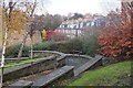
Path to the Colonies, Stockbridge
A nicely engineered sloping path leading down to the Colonies, a series of parallel streets built between 1861 and 1911 by the Edinburgh Co-operative Building Company as low-cost housing ('affordable' in today's jargon).
Image: © Jim Barton
Taken: 2 Dec 2017
0.04 miles