
IMAGES TAKEN NEAR TO
Carlaverock View, TRANENT, EH33 2PN
Introduction
This page details the photographs taken nearby to Carlaverock View, EH33 2PN by members of the Geograph project.
The Geograph project started in 2005 with the aim of publishing, organising and preserving representative images for every square kilometre of Great Britain, Ireland and the Isle of Man.

There are currently over 7.5m images from over14,400 individuals and you can help contribute to the project by visiting https://www.geograph.org.uk
Image Map
Images are licensed for reuse under creativecommons.org/licenses/by-sa/2.0
Notes
- Clicking on the map will re-center to the selected point.
- The higher the marker number, the further away the image location is from the centre of the postcode.
Image Listing (35 Images Found)
Images are licensed for reuse under creativecommons.org/licenses/by-sa/2.0
Image
Details
Distance
2
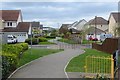
Path, Windygoul
The southwards extension of Tranent.
Image: © Richard Webb
Taken: 8 May 2015
0.12 miles
3
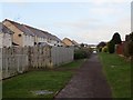
Path, Windygoul
A path between a new development and an older and bedded in expansion of Tranent.
Image: © Richard Webb
Taken: 26 Jan 2014
0.13 miles
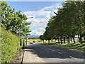
5
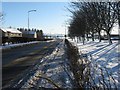
Muirpark Road
Heading south towards Ormiston and Pencaitland, through housing on the south side of Tranent.
Image: © M J Richardson
Taken: 7 Jan 2010
0.15 miles
6

Pond, Windygoul
Flood buffer on the edge of a c. 2010 housing development.
Image: © Richard Webb
Taken: 26 Jan 2014
0.16 miles
7
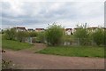
Pond, Tranent
The pond in the new houses to the south of Tranent is starting to green up.
Image: © Richard Webb
Taken: 8 May 2015
0.16 miles
8
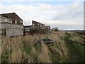
Edge of Tranent
A capped shaft, Windygoul.
Image: © Richard Webb
Taken: 26 Jan 2014
0.16 miles
9

Green space off Carlaverock Drive
Tranent has expanded southwards in the past twenty years.
Image: © Richard Webb
Taken: 15 May 2023
0.16 miles
10
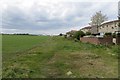
Edge of Tranent
An attempt was made to block off the path that has appeared along the current southern edge of town. Did not come to much.
Image: © Richard Webb
Taken: 8 May 2015
0.17 miles