
IMAGES TAKEN NEAR TO
Merryfield Avenue, TRANENT, EH33 1PZ
Introduction
This page details the photographs taken nearby to Merryfield Avenue, EH33 1PZ by members of the Geograph project.
The Geograph project started in 2005 with the aim of publishing, organising and preserving representative images for every square kilometre of Great Britain, Ireland and the Isle of Man.

There are currently over 7.5m images from over14,400 individuals and you can help contribute to the project by visiting https://www.geograph.org.uk
Image Map
Images are licensed for reuse under creativecommons.org/licenses/by-sa/2.0
Notes
- Clicking on the map will re-center to the selected point.
- The higher the marker number, the further away the image location is from the centre of the postcode.
Image Listing (26 Images Found)
Images are licensed for reuse under creativecommons.org/licenses/by-sa/2.0
Image
Details
Distance
1
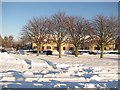
Merryfield Avenue, Macmerry
A footpath runs through the snowfield over the road. It was cleared about an hour after this was taken.
Image: © Richard Webb
Taken: 8 Dec 2010
0.02 miles
2
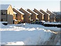
Merryfield Avenue, Macmerry
After heavy snowfall.
Image: © Richard Webb
Taken: 8 Dec 2010
0.04 miles
3
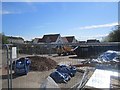
Repairs, Macmerry Primary School
Mining subsidence in the playground caused the temporary closure of the school. During stabilisation work the pupils moved to Haddington.
Image: © Richard Webb
Taken: 17 May 2013
0.05 miles
4
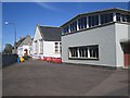
Macmerry Primary School
Closed during repairs for mining subsidence.
Image: © Richard Webb
Taken: 17 May 2013
0.06 miles
5
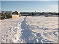
Playing field, Macmerry
After heavy snowfall; the air was below freezing, but ground heat was thawing the snow from below. Large ice crystals had formed on top of the snow, made from water vapour rising through the snow pack.
Image: © Richard Webb
Taken: 8 Dec 2010
0.07 miles
6
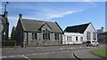
Macmerry Primary School
The school was closed due to mining subsidence. The pupils were at Haddington while the building was made safe.
Image: © Richard Webb
Taken: 17 May 2013
0.08 miles
7
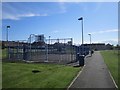
MUGA, Macmerry
Multiuse games cage on the recreation ground in Macmerry.
Image: © Richard Webb
Taken: 17 May 2013
0.09 miles
8
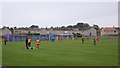
Football match, Macmerry
A big park in the middle of the village. The photograph shows one of the current football strip fashions, stripes on the front, solid on the back. It looks like there are three teams out there and it is very unpopular with kit enthusiasts.
Image: © Richard Webb
Taken: 7 Oct 2018
0.09 miles
9

Greendykes Road, Macmerry
Farm access incorporated into a recently built housing estate.
Image: © Richard Webb
Taken: 7 Oct 2018
0.13 miles
10

Main Road (A199)
Heading east through Macmerry.
Image: © JThomas
Taken: 21 Sep 2013
0.13 miles