
IMAGES TAKEN NEAR TO
Sandersons Wynd, TRANENT, EH33 1JN
Introduction
This page details the photographs taken nearby to Sandersons Wynd, EH33 1JN by members of the Geograph project.
The Geograph project started in 2005 with the aim of publishing, organising and preserving representative images for every square kilometre of Great Britain, Ireland and the Isle of Man.

There are currently over 7.5m images from over14,400 individuals and you can help contribute to the project by visiting https://www.geograph.org.uk
Image Map
Images are licensed for reuse under creativecommons.org/licenses/by-sa/2.0
Notes
- Clicking on the map will re-center to the selected point.
- The higher the marker number, the further away the image location is from the centre of the postcode.
Image Listing (37 Images Found)
Images are licensed for reuse under creativecommons.org/licenses/by-sa/2.0
Image
Details
Distance
3

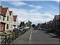
Coalgate Avenue, Tranent
Stop me and buy one. This icecream van is worth a stop, it sells proper high quality icecream. Scotland is famed for the large number of independent icecream manufacturers that supply the world's second biggest icecream consumers. (Neighbours Norway are number one)
This is a residential area built around colliery land in the days of the working East Lothian coalfield. While the square is still mostly under barley, Tranent is growing fast and there is a lot of new building going on or planned.
Image: © Richard Webb
Taken: 14 Sep 2005
0.09 miles
4

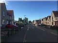
Looking South on Tranent's Coalgate Avenue
Image: © James Denham
Taken: 20 Aug 2009
0.09 miles
5

Path sign, Tranent
On the trackbed of a mineral railway from mining days. The path in the background was the road to the long vanished Blindwells Farm - lost to open cast mining and about to become a new town.
Image: © Richard Webb
Taken: 22 Apr 2020
0.09 miles
6

Path outside Tranent
This was a road to the lost farm of Blindwells. It is now cut by the new A1 and is now a litter strewn path.
Image: © Richard Webb
Taken: 3 Feb 2012
0.11 miles
7
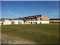
Sanderson's Wynd Primary School, Tranent
The two characters on the left were about to climb the locked gate out of the grounds. The school was closed - Summer 2020.
Image: © Richard Webb
Taken: 1 Jun 2020
0.11 miles
8

Scrub woodland, Tranent
Former farmland on the edge of town, probably awaiting development.
Image: © Richard Webb
Taken: 22 Apr 2020
0.11 miles
9

Awaiting development
There is a lot of land on the edge of Tranent which has not been cultivated for sometime. It is probably awaiting that glorious future when ordinary working folk will be able to buy/rent houses again. Now it is a litter strewn waste, lots of bird friendly weeds though. If only we can stop the dumping lowlives.
Image: © Richard Webb
Taken: 3 Feb 2012
0.12 miles
10

Awaiting development
Fields at Tranent Mains, now unused and sitting in a land bank awaiting development for housing.
Image: © Richard Webb
Taken: 21 Mar 2015
0.13 miles