
IMAGES TAKEN NEAR TO
High Street, PRESTONPANS, EH32 9SH
Introduction
This page details the photographs taken nearby to High Street, EH32 9SH by members of the Geograph project.
The Geograph project started in 2005 with the aim of publishing, organising and preserving representative images for every square kilometre of Great Britain, Ireland and the Isle of Man.

There are currently over 7.5m images from over14,400 individuals and you can help contribute to the project by visiting https://www.geograph.org.uk
Image Map
Images are licensed for reuse under creativecommons.org/licenses/by-sa/2.0
Notes
- Clicking on the map will re-center to the selected point.
- The higher the marker number, the further away the image location is from the centre of the postcode.
Image Listing (160 Images Found)
Images are licensed for reuse under creativecommons.org/licenses/by-sa/2.0
Image
Details
Distance
1

West Seaside and Salt Preston Place
West Seaside is an old name being resurrected in Prestonpans after an absence of some 75 years. Salt Preston Place reminds us of the one of the town's old names. Originally Althamer, Priest's Town Pans, Salt Preston and finally, Prestonpans. The pans refers to the salt pans for which the town was famous. Some refer to the town as Pots and Pans in a rather disparaging manner, in actual fact they have actually nailed the name as the town was also one of the most important pottery towns in Britain.
Image: © James Denham
Taken: 19 Apr 2010
0.01 miles
2

Johnnie Moat Stone
The stone was left atop beach rocks 13,000 years ago after the last Ice Age. It has great significance to Prestonpans and is a local icon.
Image: © James Denham
Taken: 24 Oct 2007
0.02 miles
3

Brick, stone and bedrock, Prestonpans
Various constituents of the sea wall, built and natural.
Image: © Jim Barton
Taken: 31 May 2019
0.02 miles
4

High Street scene in Prestonpans in East Lothian
At the site of Alt Hamer House of old and the last salt works in the town.
Image: © James Denham
Taken: 19 Apr 2010
0.02 miles
5

Prestonpans overlooking the Firth of Forth
Image: © Mat Fascione
Taken: 29 Apr 2018
0.03 miles
6
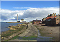
Seafront, Prestonpans
Looking towards Cockenzie Power Station.
Image: © michael ely
Taken: 17 Aug 2010
0.03 miles
7

Prestonpans Town Hall doorway
The semicircular pediment incorporates the crest of the Burgh of Prestonpans, as well as symbols of the local industries. These included fishing (anchor), mining (pick), salt production (shovel) and agriculture (sheaf and sickle). See http://www.geograph.org.uk/photo/3516238
Image: © Alan Murray-Rust
Taken: 10 Jun 2013
0.03 miles
8

High tide at Prestonpans
A natural sea wall with man-made additions protecting these houses by the shore at Prestonpans.
Image: © Jim Barton
Taken: 10 Aug 2010
0.03 miles
9
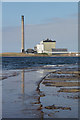
Shoreline with Cockenzie Power Station
Reflected in water on the causeway along the shore at Prestonpans.
Image: © Alan Murray-Rust
Taken: 10 Jun 2013
0.03 miles
10

Prestonpans Town Hall
This is a municipal building in the High Street. The building, which is largely used as a community events venue, is a Category C listed building.
In April, 2021, the Battle of Prestonpans (1745) Heritage Trust acquired a five-year lease over the building from East Lothian Council with the objective of renovating it and using part of it for museum space. The museum was intended to commemorate the Battle of Prestonpans at which the Jacobite forces led by the Stuart exile and pretender to the throne, Charles Edward Stuart, defeated a government army under Sir John Cope, just to the south of the town centre on 21 September 1745. (Wikipedia)
Image: © Eirian Evans
Taken: 10 Sep 2021
0.03 miles