
IMAGES TAKEN NEAR TO
Bankfoot, PRESTONPANS, EH32 9SG
Introduction
This page details the photographs taken nearby to Bankfoot, EH32 9SG by members of the Geograph project.
The Geograph project started in 2005 with the aim of publishing, organising and preserving representative images for every square kilometre of Great Britain, Ireland and the Isle of Man.

There are currently over 7.5m images from over14,400 individuals and you can help contribute to the project by visiting https://www.geograph.org.uk
Image Map
Images are licensed for reuse under creativecommons.org/licenses/by-sa/2.0
Notes
- Clicking on the map will re-center to the selected point.
- The higher the marker number, the further away the image location is from the centre of the postcode.
Image Listing (62 Images Found)
Images are licensed for reuse under creativecommons.org/licenses/by-sa/2.0
Image
Details
Distance
1

High Street, Prestonpans
At the western end of the village. This is the B1348 going east to Seton Sands.
Image: © M J Richardson
Taken: 9 Mar 2010
0.02 miles

3

The shore and western edge of Prestonpans
From near the John Muir Way coastal path.
Image: © M J Richardson
Taken: 9 Mar 2010
0.03 miles

5

Junction at west end of Prestonpans
The High Street with the junction of Prestongrange Road at Cuthill, known locally as the 'Cittle'. The houses are in Inchview North.
Image: © James Denham
Taken: 6 Jun 2008
0.04 miles
6

Path near Morrison's Haven
The coastal path, west of Prestonpans.
Image: © Richard Webb
Taken: 7 Feb 2015
0.05 miles
7

Housing estate by the shore at Prestonpans
Image: © Oliver Dixon
Taken: 29 Apr 2019
0.06 miles
8

Coltsfoot by the roadside
An early flowering dandelion relative [Tussilago farfara], with flowers that appear in early spring before the leaves.
Image: © M J Richardson
Taken: 9 Mar 2010
0.06 miles
9
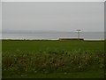
Reclaimed land, Prestonpans
The road once ran beside the shore here, but colliery and elsewhere, power station waste has moved the coast out into the Firth of Forth between Prestonpans and the mouth of the Esk.
A bank has been built in the foreground to keep caravans and dumpers off the links. In Summer it is covered in flowers.
Image: © Richard Webb
Taken: 1 Jan 2016
0.06 miles
10

Prestonpans
From the west. The concrete structure carried flyash from Cockenzie power station to Levenhall Links for disposal.
Image: © Richard Webb
Taken: 12 Nov 2017
0.06 miles