
IMAGES TAKEN NEAR TO
Stevenson Way, LONGNIDDRY, EH32 0PF
Introduction
This page details the photographs taken nearby to Stevenson Way, EH32 0PF by members of the Geograph project.
The Geograph project started in 2005 with the aim of publishing, organising and preserving representative images for every square kilometre of Great Britain, Ireland and the Isle of Man.

There are currently over 7.5m images from over14,400 individuals and you can help contribute to the project by visiting https://www.geograph.org.uk
Image Map
Images are licensed for reuse under creativecommons.org/licenses/by-sa/2.0
Notes
- Clicking on the map will re-center to the selected point.
- The higher the marker number, the further away the image location is from the centre of the postcode.
Image Listing (32 Images Found)
Images are licensed for reuse under creativecommons.org/licenses/by-sa/2.0
Image
Details
Distance

2
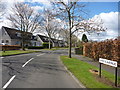
East Lothian Townscape : Kings Avenue, Longniddry
In the pleasant low-density post-war residential areas of Longniddry the fine roadside trees separating the roads from the pavements are the icing on the cake.
Image: © Richard West
Taken: 26 Apr 2013
0.06 miles
3

East Lothian Townscape : Follow The Curves
The lines of the road lead the eye towards Kings Avenue, Longniddry.
On a fine spring day such as this the well established low-density residential districts of Longniddry offer much that is pleasing and easy on the eye.
Image: © Richard West
Taken: 26 Apr 2013
0.06 miles
4
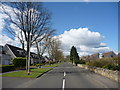
East Lothian Townscape : A Peaceful, Easy Feeling
Blue skies, sunshine, a fine, wide residential street with trees, pavements and, best of all, no cars. Suburban bliss!
Image: © Richard West
Taken: 26 Apr 2013
0.07 miles
5

Open space, Longniddry
An informal recreation area in the middle of the 1960s housing expansion in Longniddry.
Image: © Richard Webb
Taken: 27 Nov 2009
0.08 miles

7

Kings Avenue, Longniddry
Looking towards the junction with Kings Park.
Image: © Mary and Angus Hogg
Taken: 1 Aug 2009
0.11 miles
8

Kings Court, Longniddry
This residential area was built during the early 1970s to accommodate Edinburgh commuters.
Image: © Mary and Angus Hogg
Taken: 1 Aug 2009
0.12 miles
9

East Lothian Townscape : Missing Letters On Kings Avenue, Longniddry
"COTLANDS PARK? Would that be AMPDEN or URRAYFIELD?"
Image: © Richard West
Taken: 26 Apr 2013
0.12 miles
10
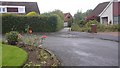
King's Park, Longniddry
Houses arranged around a turning circle.
Image: © Richard Webb
Taken: 26 Aug 2018
0.12 miles